6 Real-World Use Cases of Drones for Pipeline Inspection
3.1.
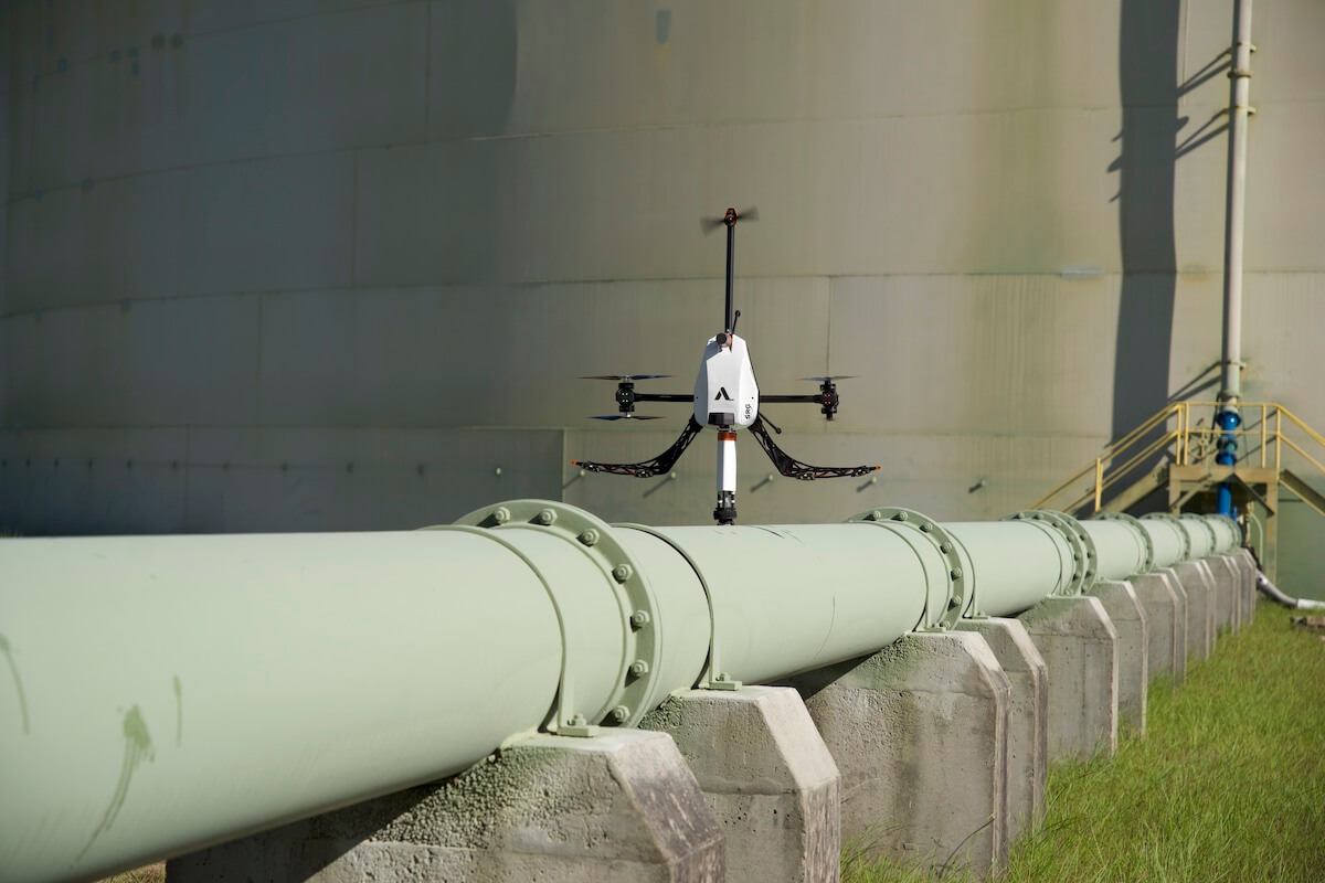
Leak and Emission Detection
3.2.
Wall Thickness Measurements
3.3.
Pipeline Route Vetting
3.4.
Pre-Planned Monitoring Missions
3.5.
Digital Twin Creation
3.6.
Underwater Pipeline Inspection
4.
Pipeline drone inspections are faster, safer, and cheaper
Pipelines are the arteries of the energy sector, distributing natural gas to more than 78.3M U.S. households and commercial enterprises. Such critical infrastructure operates under strict safety requirements, as you would expect.
For instance, the Biden Administration has tightened regulations for 400k miles (approx. 640K km) of the pipeline system, institution of new anti-corrosion measures and geocoding rules. Meanwhile, across the globe, the Maritime Union of Australia (MUA) plans to enforce stricter controls after a recent ExxonMobil pipeline rupture.
As health and environment stakes rise, so does the importance (and cost) of pipeline inspections. Global energy leaders are already acting on it, reducing inspection expenses and time using drones.
How Drones Help With Pipeline Inspection
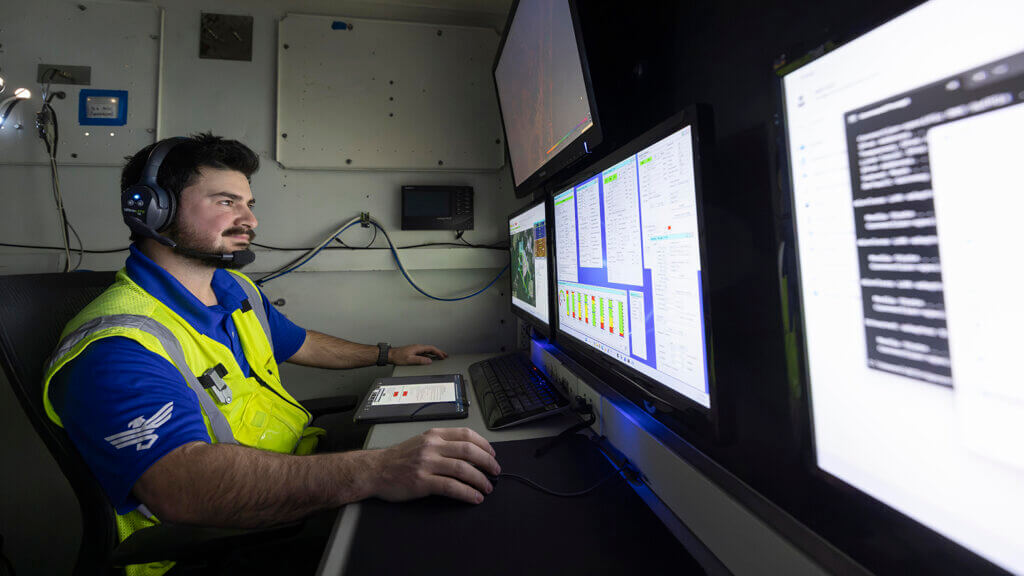
Global oil and gas companies, as well as inspection companies, are actively enlisting drones to streamline, speed up, and reduce the cost of asset integrity management. Inspections that used to take weeks and a fortune to plan and execute now take a few days and one subscription with a drone company. For example, doing non-destructive testing with Voliro T is 2.5X faster than any traditional inspection.
But speed and affordability are not the only attractors. The best inspection drones include HD zoom cameras and NDT tools that help collect a lot of valuable asset data, from its age and condition to the exact location of each defect and leak severity. Pack it with 3D modeling and AI algorithms, and you’ve got a system that monitors pipeline integrity with unbeatable precision.
Oil and gas companies no longer need a crew of inspectors and chartered airplanes to survey miles of pipelines or inspect assets at height. Using drones, asset owners can inspect above-ground transportation pipelines even in hail, rain, or poor lighting conditions, as well as subsea infield pipelines with marine AUVs.
The main benefits of drone pipeline inspections include:
Speed and cost-efficiency: Assessments and tests don’t require specialized equipment, costly scaffolding, or rope access, even for elevated pipeline sections. Drone pipe inspection can be a 1-person job.
Reliable results: Equipped with NDT probes and sensing technology, drones pinpoint the exact location, size, and depth of cracks, dents, corrosion, insulation loss, or debonds. They can reliably scan rough, bumpy surfaces (such as welding and seams).
Predictive maintenance: Drones spot defects as small as 0.2-0.05 mm, enabling early detection of structural problems and quick remediation. Collecting asset data more frequently allows you to create an optimized maintenance schedule to minimize operational downtime.
Access to hard-to-reach spots: With 360° aerial mobility and relatively small size, drones can easily inspect even inaccessible pipeline components (like pipe elbows and angled sections).
Improved workers’ safety: Drones limit personnel exposure to hazardous conditions, like blasting, toxic gas emissions, dangerous oil leaks, and extreme surface temperatures. Operators don’t risk working at heights or traveling to remote locations.
Almost no downtime: Drones can test in-service pipelines even if the surface temperature is as high as 200°C/400°F. Specialized high-temperature NDT probes provide detailed information about the piping condition without the need for planned downtime.
Improved regulatory compliance: As per API 570 standard, you must test flammable/combustible pipes with significant health and environmental risks every 5 years. For remote pipes with flammable but not vaporizing contents, the interval is 10 years. Pipe inspection drones help perform regular testing and stay compliant with the regulations.
6 Real-World Use Cases of Drones for Pipeline Inspection
The use of drones for pipeline inspection isn’t a new practice. Back in 2013, BP started testing unmanned aerial vehicle (UAV) technology in Alaska for data collection, although the first footage was black and white. Three years later, Gail India implemented drone patrolling after a fatal safety incident near its pipelines. Then, in 2018, Marathon Petroleum deployed UAVs to check the integrity of their pipes after Hurricane Harvey.
Yet, all these audits were primarily visual. Modern oil and gas inspection drones have more capabilities than photo and video capture. They can be used for:
Data collection for real-time condition monitoring
Underwater pipeline inspection
Leak and Emission Detection
Pipelines are the safest way to distribute gas and fuels, but leaks and emissions from daily wear are inevitable. Between 2019 and 2023, pipeline ruptures released nearly 9.7 billion cubic feet of gas into the atmosphere, which poses a serious climate change concern. This calls for more regular inspections.
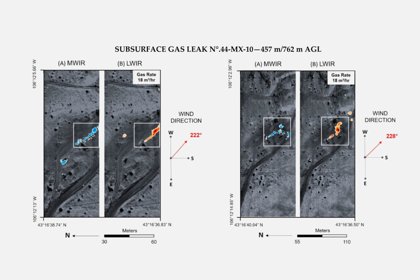
Drones, fitted with HD cameras, provide immediate insight into the leak’s precise location and severity, enabling faster emergency response. For instance, during last year’s Poole Harbour oil leak, drones assisted in estimating the extent and direction of the oil spill across 10K acres. With thermal detectors and sniffer sensors, drones can spot even the lightest emissions, enabling early mitigation of environmental impacts. Aramco, for instance, continuously monitors 5K km (≈3.1K miles) of pipelines and 900 injection wellheads for methane leaks using thermal gas imaging drones. Equipped with laser absorption spectrometry, the drones can identify gas concentration with hair splitting accuracy.
Sample aerial detection of concentrated methane emissions. Source: MDPI
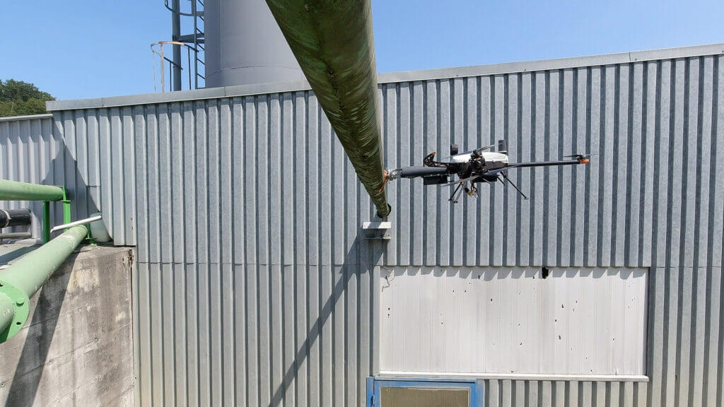
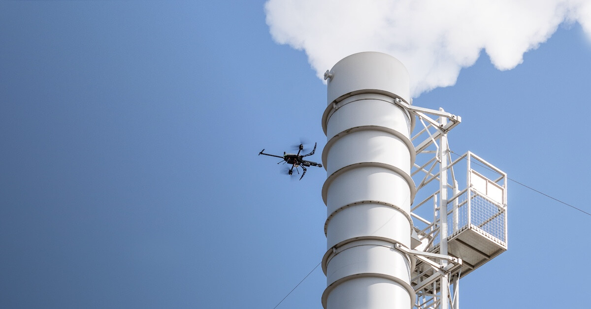
Wall Thickness Measurements
The leading cause of pipeline incidents is corrosion. In 2023, internal corrosion caused 18.9% of pipeline failures and external — 8.8%, resulting in a total economic impact of $61M in the US, according to the Pipeline & Hazardous Materials Safety Administration.
The common reasons for corrosion are coating disbanding from the pipe surface and missing or damaged coatings. Regular coating and wall thickness measurements can help minimize these mishaps. For example, Voliro T inspection drone has several specialized payloads for thickness measurements. Inspectors can use ultrasonic testers and eddy-current probes to analyze wall and insulation thicknesses down to 3 mm and detect corrosion at the early stages. For heated pipes, Voliro T offers a high-temp UT probe capable of testing assets up to 260 °C / 500 °F. Middough, a U.S. engineering company, used a Voliro drone with an EMAT probe to collect piping thickness measurements. With EMAT, no surface prep is needed, allowing easy inspection of remote assets. During the most recent inspection, Voliro’s technology provided Middough with 50-100 high-precision corrosion readings per hour.
Wall Thickness Measurement of an Elevated Pipe
Pipeline Route Vetting
Route selection is crucial to pipeline construction integrity. The regulations call for avoiding constructions near populated zones, natural reservations, road & rail crossings, and water bodies.
Yet, it is not always possible to account for all topography factors. Trees, bushes, and soil defects may only become apparent on site, unaccounted for in the planning process. Likewise, regulations may be bent by on-site teams due to an error, or piping may be damaged during installations.
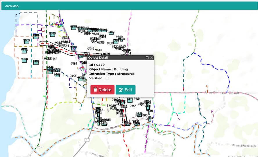
Drones help oil and gas companies monitor construction projects with greater efficiency. At its Pennsylvania Chemicals branch, Shell used drones to collect data for creating a 3D model of its 400-acre construction site. The drone sent readings of about 250 acres of land every hour in real time to provide construction progress updates. Petronas went a step further and built a predictive analytics tool that uses drone aerial surveillance data to identify third-party encroachment threats and geohazards along the planned pipeline routes.
A map showing possible structural conflicts in real-time. Source: Petronas
Pre-Planned Monitoring Missions
With the AI revolution looming and the rise of technology automation, drone inspections are becoming more and more autonomous. The latest UAVs only require human inputs for
mission planning and one-click dispatches. Using computer vision and advanced navigation algorithms, autonomous drones head to the inspection site, scan assets while avoiding obstacles, and return to the home base.
In a test run, SoCalGas used a hydrogen-powered DS30 drone to monitor hard-to-access areas across its pipelines. With a flight time of 120 minutes, the drone can cover large distances and supply the company with high-precision asset condition data, as well as imagery for aerial mapping and three-dimensional topographic model creation. Chevron, in turn, uses AiRanger UAV to run pre-planned and automated gas and oil pipeline inspections across its pipelines. AiRanger, produced by American Aerospace Technologies, Inc. (AATI), uses machine learning models to learn from the data it collects, improving inspections in the future.
The pilot in command oversees an AiRanger’s autonomous flight. Source: Chevron
Digital Twin Creation
Drones also enable the creation of digital twins — a data-driven 3D representation of your pipeline’s geometry and physical characteristics. Using drones, you get precise pipeline photogrammetry, dimensional information, and real-time condition updates. Put all this historical and current data together in an analytical model and you have an exact virtual replica of your asset, which you can monitor 24/7.
WaterNSW, responsible for monitoring the Warragamba Pipeline in Sydney, enlisted a local drone company to help with asset modeling. The company created a detailed 3D pipeline model, using data from 118K photos attained during 50K drone missions.
Moreover, there’s a potential for creating digital twins of planned, not yet constructed pipelines. Generative AI can help model different pipeline designs and operation scenarios, enabling you to select the most optimal one. For that, however, AI models will need to be trained on accurate pipeline data, which drones can help collect.
Underwater Pipeline Inspection
There are more than 40K miles (≈64K km) of oil and gas pipelines in the U.S. offshore area, especially susceptible to corrosion and decay. Traditional methods for underwater inspections require expensive equipment and specialized dive teams. Not to mention all the protective gear required and the risks involved.
As a safer alternative, businesses are looking into unmanned underwater vehicles (UUV) — compact vessels equipped with everything needed for inspections at depths more than 150 meters (490 feet) — a level at which humans develop high-pressure nervous syndrome.
Made of waterproof PVC material, modern UUVs can withstand extreme temperatures and pressure changes — all without compromising inspection accuracy. A propeller, HD cameras, and lights enable the operator to navigate through water depths. Mounted with specialized payloads, such UUVs can effectively measure pipeline wall thickness and locate subsurface defects.
Saipem’s FlatFish, for instance, is capable of fully autonomous pipeline inspections in depths of more than 2000 meters (over 6500 feet). The drone generates detailed 3D models, detects small dents with high-precision optics, and boasts AI-driven navigation.
Another example is Clean Sea, an underwater unmanned vehicle developed by Eni. It can perform both subsea pipeline inspections and water pollution analysis. Operators can use the drone in either remote control or fully autonomous mode. As of now, Clean Sea helped Eni inspect more than 1K km (≈621 miles) of underwater pipelines.
Pipeline drone inspections are faster, safer, and cheaper
Inspection drones are equipped with innovative emission detectors, heat sensors, LiDAR systems, autonomous modes, and AI-powered analytics, helping oil and gas companies collect more comprehensive data. NDT probes are gradually becoming better, more precise, and fit for extreme operating conditions. New payloads, like Voliro’s first-of-its-kind Pulsed Eddy Current probe, emerge on the market.
Voliro T has all the NDT inspection characteristics for effective pipeline inspection: an HD camera, 360° aerial mobility, full-flight stabilization, 6 interchangeable probes, and AI-assisted flight autonomy. In addition, we offer a full-service subscription with 3-day operator training and immediate payload replacements.