1.
Best Telecom Tower Inspection Drones Ranked
1.1.
Voliro
1.2.
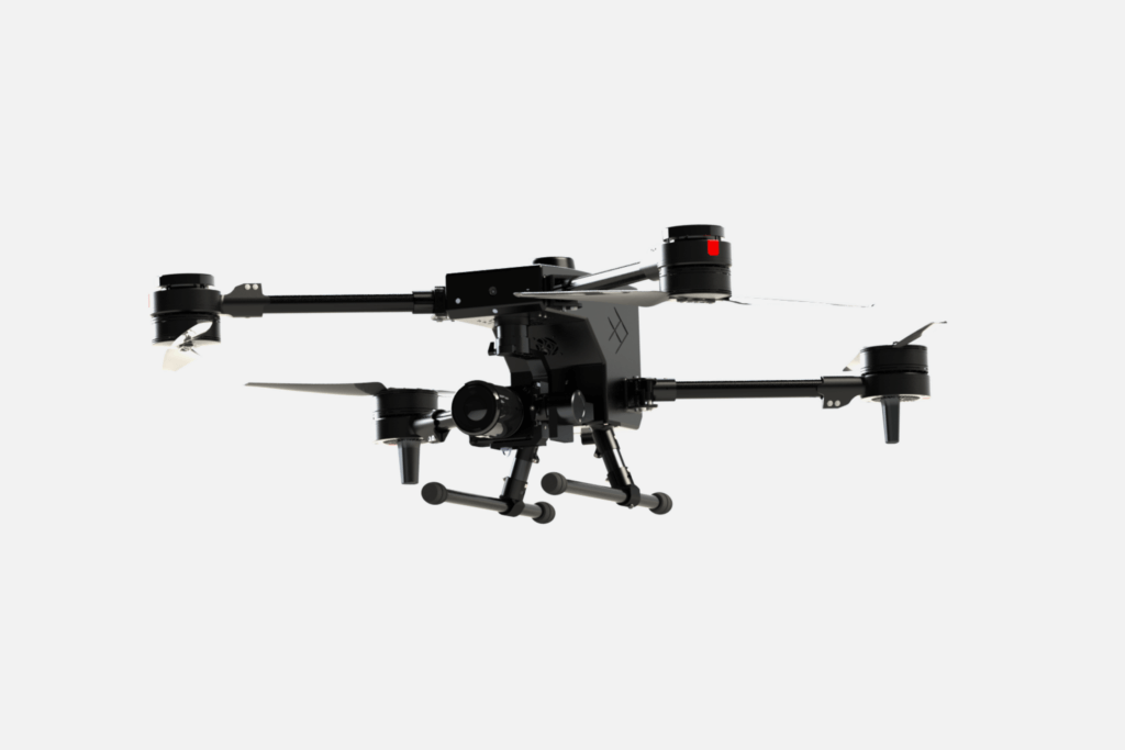
Skydio X10
1.3.
ANAFI Ai
1.4.
DJI Mavic 3 Enterprise
1.5.
IF800 Tomcat
1.6.
Osprey
2.
Drone Tower Inspection Reduces Costs and Elevates Quality
1.
Best Telecom Tower Inspection Drones Ranked
1.1.
Voliro
1.2.
Skydio X10
1.3.
ANAFI Ai
1.4.
DJI Mavic 3 Enterprise
1.5.
IF800 Tomcat
1.6.
Osprey
2.
Drone Tower Inspection Reduces Costs and Elevates Quality
Telecom infrastructure is critical for reliable connectivity, especially now when we can’t tolerate a poor signal for more than five minutes.
Self-supporting towers must be inspected for structural integrity every three years and guyed towers — every five years. Many telecom companies conduct more frequent inspections to detect and address issues early. It’s better to fix paint and coatings when cracks appear than to wait for corrosion to develop.
Cell tower inspection by drones increases the efficiency of asset inspections and enables automated data collection for ongoing monitoring. Thanks to fast deployment and omnidirectional mobility, drones help inspect hard-to-reach areas without chartering expensive lifting equipment or sending people up by the rope.
Learn which inspection drones are best for telecom companies.
When selecting cell tower inspection drones we relied on professional reviews and inspecting teams’ feedback.
For cell tower inspection, drones must have advanced navigation sensors for close-to-surface hovering and an easy approach from any direction for industrial photogrammetry. We also prioritized models with long transmission ranges and reliable connectivity due to metal interference. Lastly, we assessed payload range and customization options to create the following list of the best telecom inspection drones:
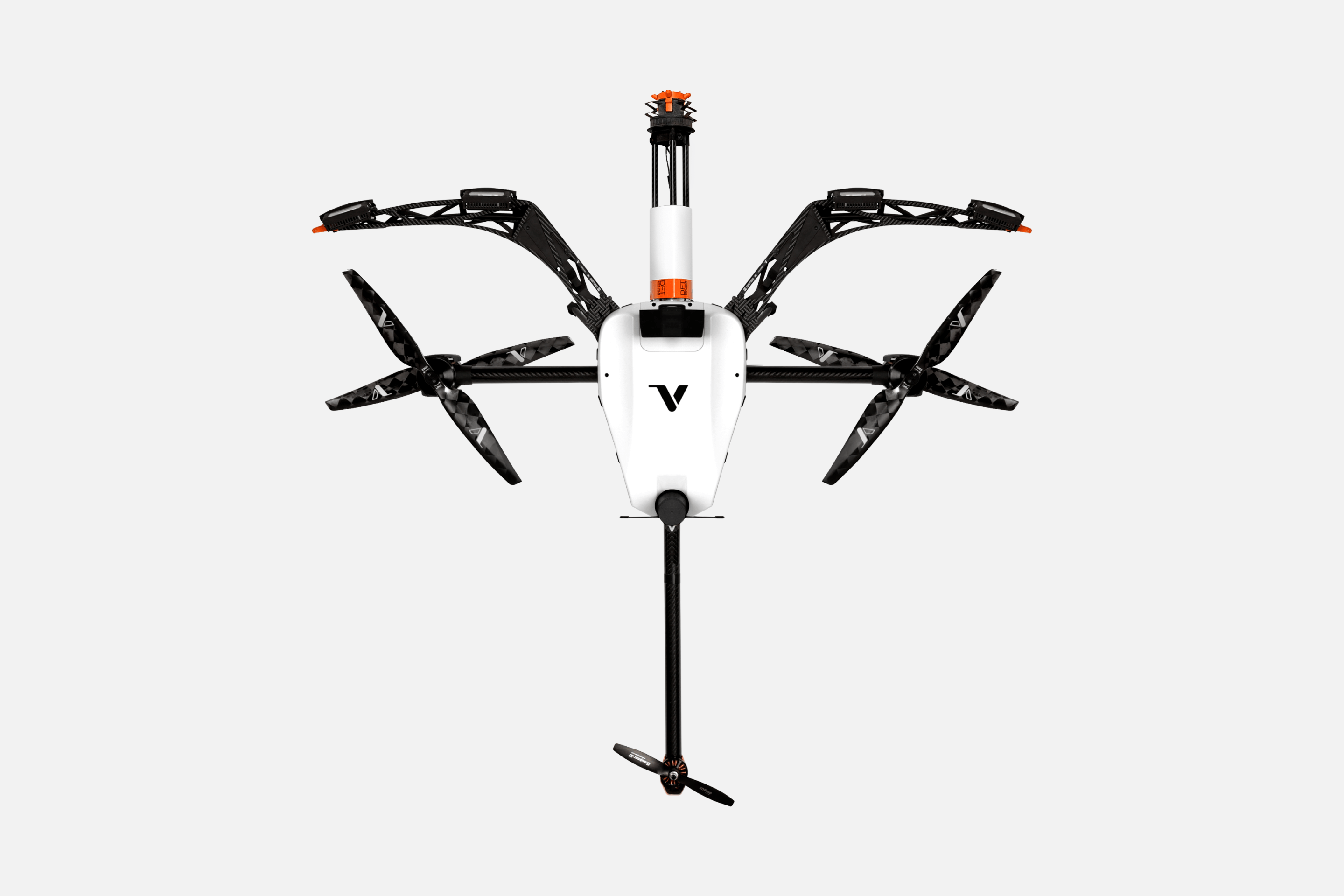
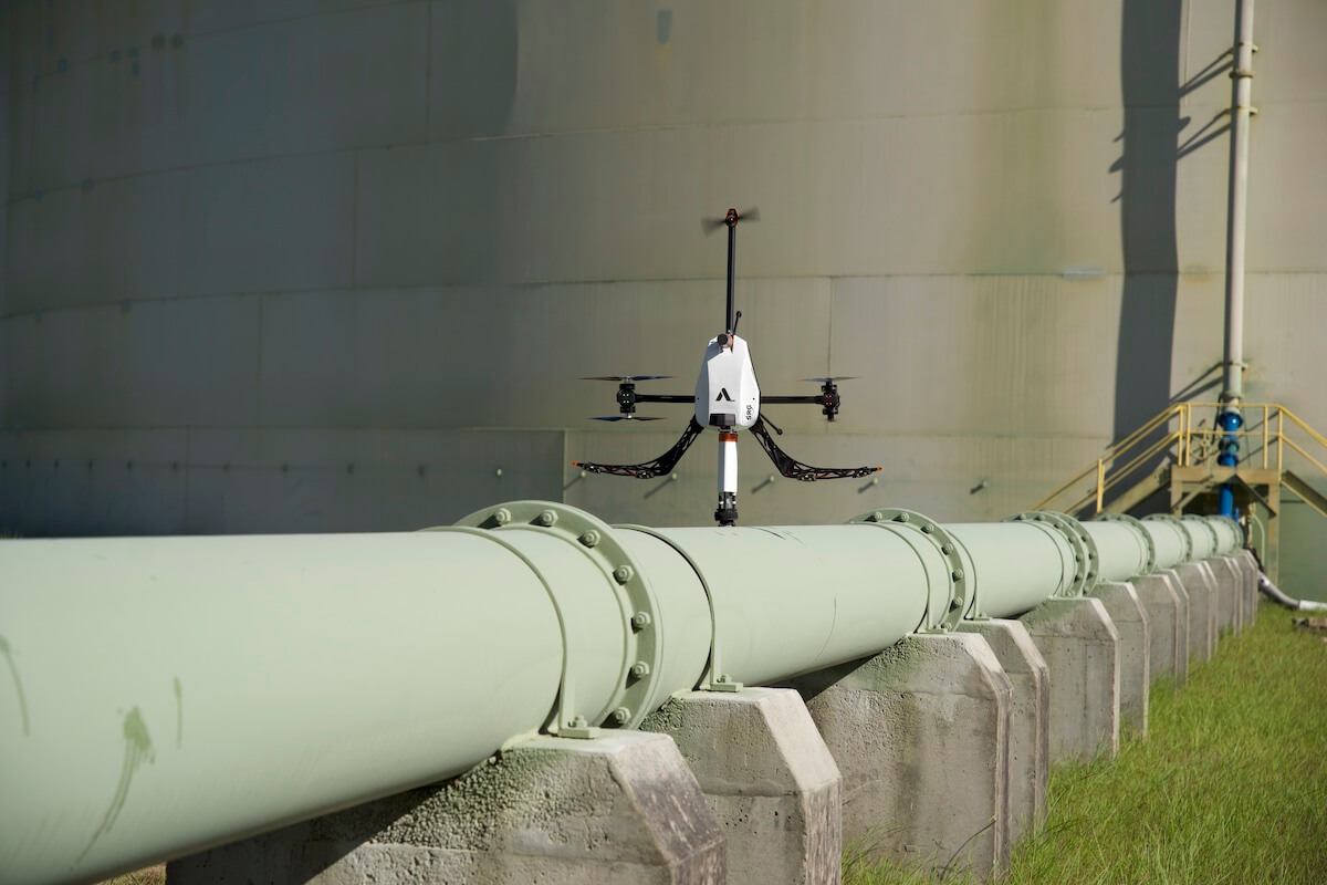
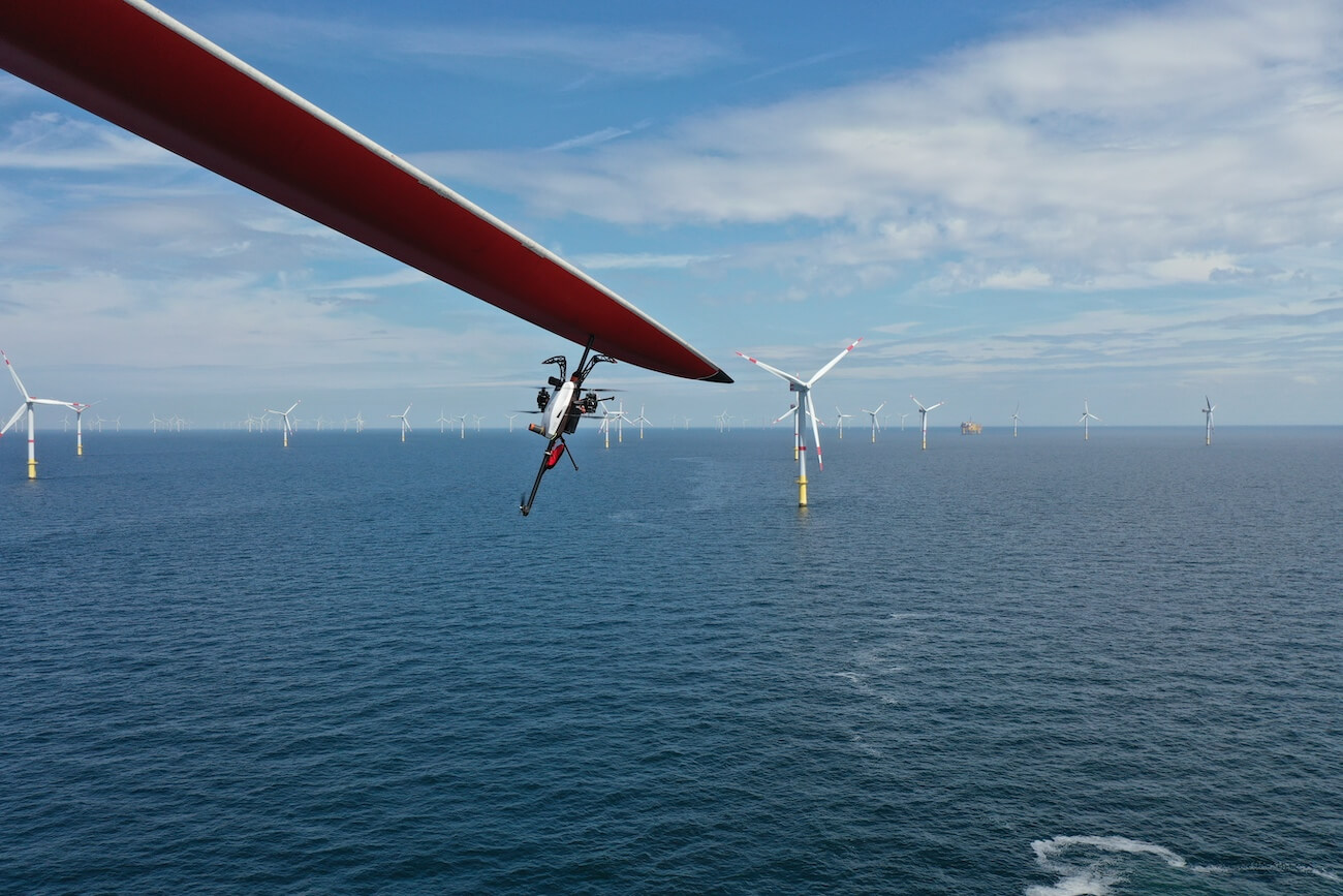
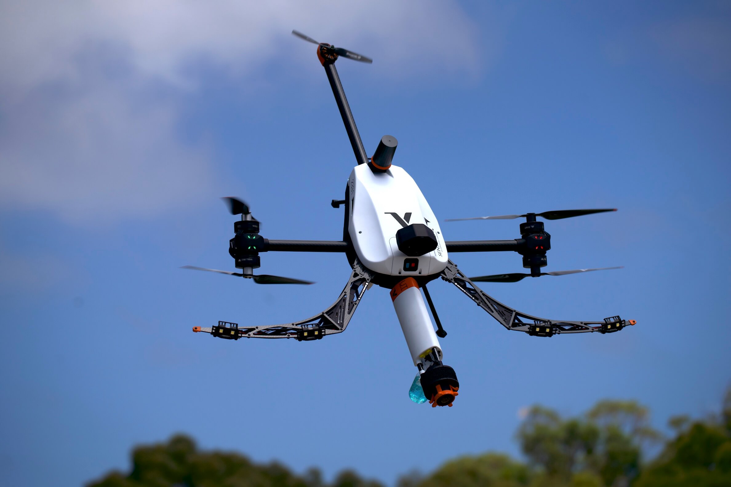
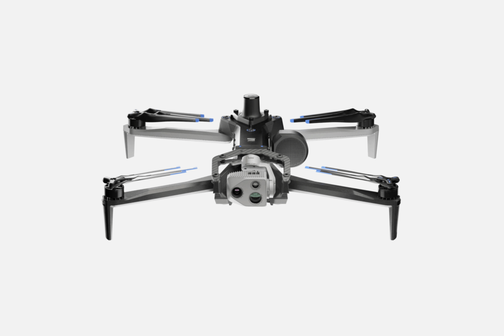
If you want to get more than just crisp visuals during telecom drone inspections, Voliro’s technology may be the answer. Featuring a proprietary tiltable rotor system and advanced sensing capabilities (courtesy of two six-packs of LiDAR and vision-based navigation sensors), Voliro T can perform non-destructive testing (NDT) at height. The drone can safely hover close to the surfaces and apply up to 30 N of stable force and several Nm of torque to structures using the mounted payloads.
The payload options include:
Just like conventional NDT tools, all Voliro payloads comply with regulatory standards but allow collecting more readings in less time. You can inspect telecom assets in use without planned shutdowns for rope access or lifting equipment.
Moreover, with a high-temperature UT probe operational at 0 – 260 °C / 32 – 500 °F, you can inspect heated components and surfaces. The same goes for protective coating inspections — no need to wait for the surface to set. Using Voliro’s drones, Bouygues Telecom inspected 10+ telecom towers in a day, right after painting, eliminating repeat trips and costly equipment movements.
At the same time, you’re still collecting great visual footage from a 4K 12 MP inspector camera with a frame rate of 30/60fps. A 2K 12 MP pilot camera with a 140° horizontal FoV provides superb visibility for navigation, and you can switch to a semi-autonomous flying mode when uncertain. Voliro remains stable even in GPS-denied and high-interference environments.
Main features
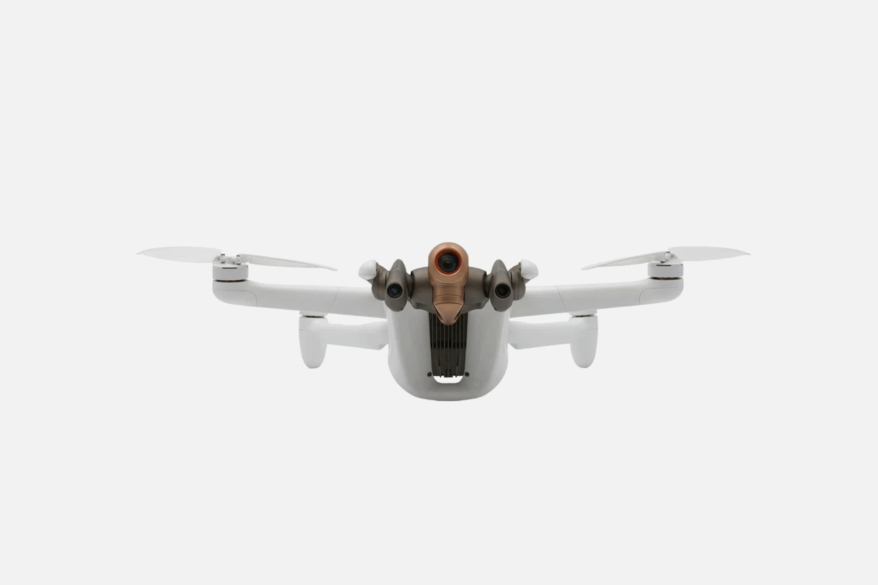
Skydio X10 is one of the few commercial inspection drones with a triple camera sensor, combining narrow, telephoto, and radiometric thermal cameras. The 1/2″ 48MP CMOS sensor with a 35 mm focal length provides clear visuals of surface-level deformations.
FLIR Boson+ sensor delivers thermal imaging with a sensitivity down to <=30 mK — great for testing overheating components or assessing antenna heating during a telecom tower drone inspection. With a max flight time of 40 minutes, Skydio X10 offers multiple opportunities to approach the asset from different angles. The max flight speed of 45 mph / 72 km/h and a max wireless range of 12 km (plus 5G connect) means you don’t have to go deep into the field. AI flight assistance and obstacle avoidance ensure the mission goes as planned. IP55 rating means it can fly in any weather.
Beyond robust hardware, Skydio also has a stellar drone data processing platform. The Skydio 3D Scan Adaptive Mapping offers contour-hugging motion planning for complex flight routes around structures. Once the route is complete, you can send the drone to automatically collect data for a 2D or 3D asset scan. So if you’re looking to do drone tower inspection as part of your asset management program, Skydio X10 is a great option.
Main features:
ANAFI Ai by Parrot is another great choice for photogrammetry missions. It has a 48 MP 1/2” CMOS sensor (similar to Skydio X10), plus a Quad Bayer color filter pattern for high-resolution still photos and a wide dynamic range.This lends top sharpness to the images — irregularities can be picked out without questioning whether it’s a granny’s photo.
You also get 10 stops of dynamic range in Standard mode and 14 stops in HDR shoot mode for consistent point clouds and high-quality asset reconstructions in 2D/3D. The camera sits on a 6-axis hybrid stabilization gimbal with a controllable range of -90° to +90°, providing excellent visibility into all nooks and crannies.
ANAFI Ai is also among the few tower inspection drones to use 4G as the main data link with an average streaming latency of 300ms. This reduces interference when flying (semi-)autonomous VLOS and BVLOS missions close to metallic structures or in dense, high-rise areas. The data link is fully encrypted, protecting both the flight software and data transfer privacy. Flight planning is easy with Parrot’s open-source application, which includes 3 free 3D models (including a tower scan) from PIX4Dcloud. You can add control features using the SDK kit, which provides access to all flight sensors, including obstacle avoidance sensors, an occupancy grid, and internet access.
Main features:
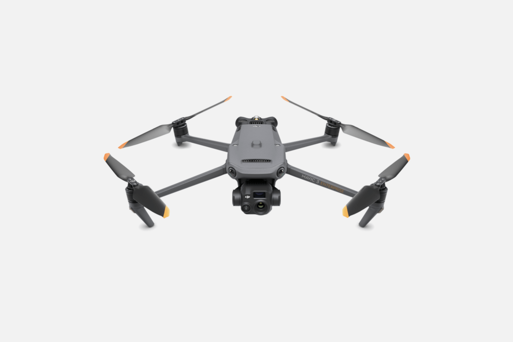
DJI Mavic 3 Enterprise borrows some of the best features of its Mavic 3 Pro camera drone and meshes these with enhancements in positioning accuracy and imaging sensors. Flight time remains at 45 minutes and mat speed at 21 m/s, but the max flight distance for DJI Mavic 3 Enterprise increased to 32 km with the new quad-antenna O3.
The flight time remains at up to 45 minutes and the max flight speed at 21 m/s, but the max flight distance for DJI Mavic 3 Enterprise increased to 32 km, thanks to the new quad-antenna O3. It also offers great stability in high-interference environments. The new 100W fast-charging three-battery station and hot swapping reduce downtime between flights.
Camera systems underwent a major overhaul. DJI Mavic 3 Enterprise comes in two versions: 3E with a wide 4/3 CMOS, 20MP and 56X zoom camera, while 3T includes a third thermal camera with a 640 × 512 resolution. The cameras also got a low-light upgrade, offering better visuals in dim conditions.
For obstacle avoidance, there’s the APAS 5.0 system from Mavic 3 Pro (which has shown great reliability). Another helpful feature for telecom tower drone inspection is customizing proximity alarms and braking distance for greater structural proximity in orbiting flights. You can also save mission actions, gimbal orientations, and zoom levels for automated flights. The upgraded return-to-home (RTH) feature reduces the hassle of finding the fastest route home.
Main features:
Released in June 2023, IF800 Tomcat quickly drew some attention thanks to its compact design and lavish flight time of 42-54 minutes (depending on the payload). Thanks to the foldable frame, the drone is just 36 x 44 x 20 cm when stored and weighs about 4.2 kg / 9.2 lbs without batteries. So it’s easy to transport for field missions.
Despite the trim shape, IF800 is a powerful machine with a max air speed of 22 m/s /49 mph and the capacity to lift 3 kg/6.6 lbs in payload. An IP43 humidity rating and wind resistance up to 10 m/s / 19 knots also let you do tower drone inspection in any weather.
But what really makes IF800 Tomcat a top contender for the best tower inspection drone is its payload compatibility. In total, you’ve got a choice of 20+ payloads — optical, infrared, LiDAR, and multispectral. Optics selection includes a Sony LR1 Industrial Camera with a full-frame back-illuminated 61MP Exmor R CMOS sensor and UHD 4K60 8-bit H.265 recording capability. Or Sentera 65R, with RGB mosaic mode, a detailed digital surface model (DSM), and a ground sampling distance of 0.45cm/pixel. For thermal inspections, you can mount Gremsy VIO F1, combining a 4K zoom sensor, a 640×512 radiometric thermal camera, and an integrated 2400m laser rangefinder.
Main features:
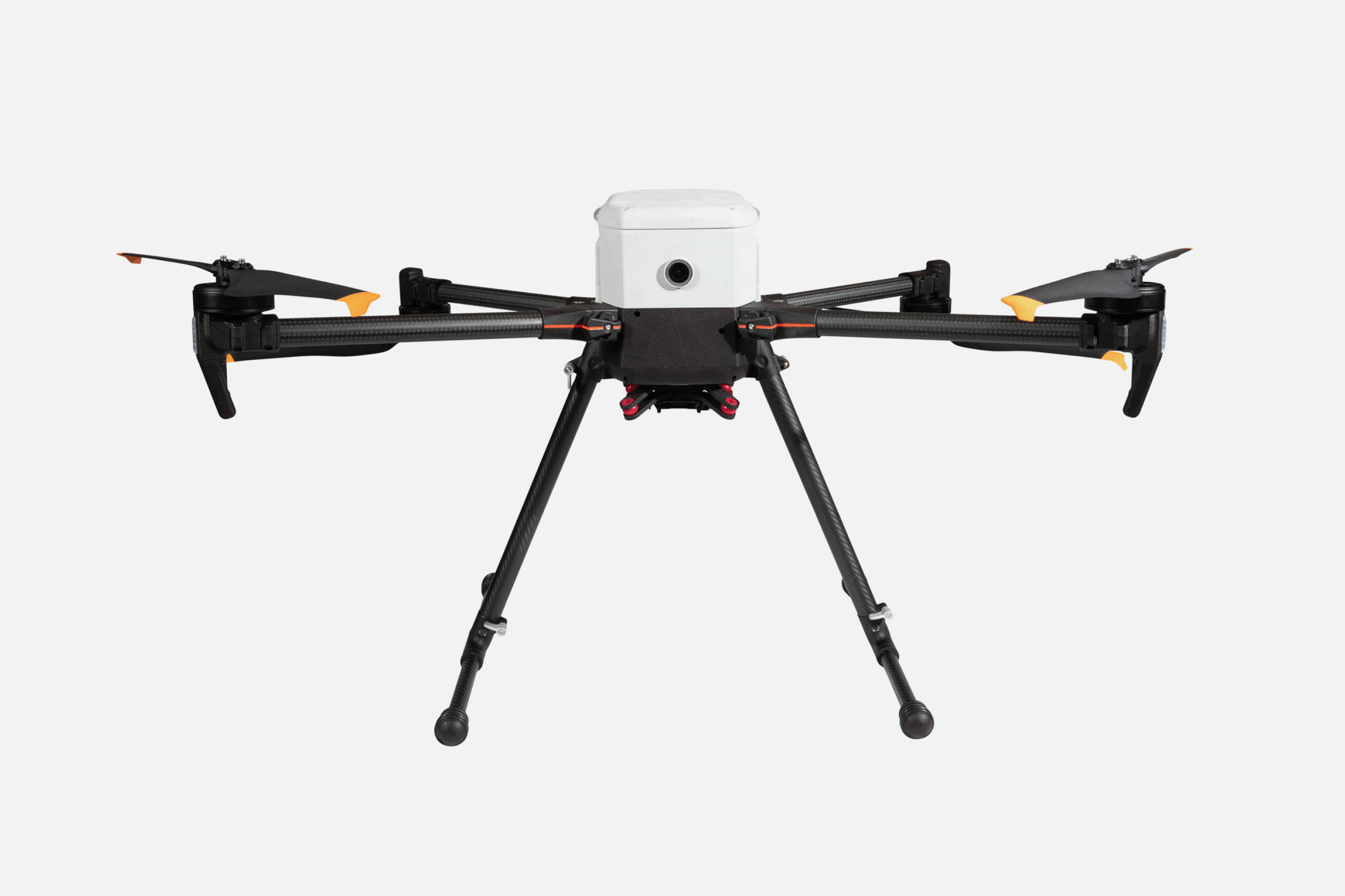
Osprey drone from Skyfish just got on the market in April 2024, but it’s already touted as a good alternative to the DJI M30 series. Made in Montana, US, this enterprise drone covers two use cases: infrastructure inspection and Intelligence, Surveillance and Reconnaissance (ISR).
As a drone for inspection, Osprey hits all checkboxes when it comes to mobility, imaging capabilities, and collision avoidance. Similar to IF800 Tomcat, Osprey is compatible withSony LR1 61MP camera for cell tower drone inspection and photogrammetry scenarios and there’s also NextVision Raptor for ISR, plus an option to integrate custom payloads on-demand.
The Skyfish platform, available with the hardware purchase, helps build 3D models from collected data points and transform them into asset digital twins. You can also export data to other tools like Bentley, Pix4D, and Autodesk.
Thanks to frame-synchronized geotagging, the platform has top-notch location accuracy. Sub-centimeter data gets injected in every still and moving frame, as well as collision avoidance systems for safer cruising. Osprey relies on an onboard edge computer for sensor data fusion and subsequent path building with AI. The standard transmission range with an onboard RTK GPS solution is 5-8 km/3 to 5 miles. It can be further extended with an RTK base station.
Main features:
Drones have become a staple among inspection teams, helping telecom companies keep cell tower installations in tip-top shape. Since drones can take HD pictures, volumetric measurements, and thickness readings, technicians no longer need to expose themselves to risk and asset owners — spend extra on specialized lifting equipment or deal with the astronomical costs of downtime.
Thanks to versatile robotic platforms like Voliro, inspectors can perform close-to-surface work without worrying about asset damage due to collision or hardware loss due to signal interference. The drone’s optimized body design, sensor-based navigation, and AI interaction assistant make inspections at height a simple, streamlined task.