The Best Inspection Drones for Commercial Use Cases
Table of Contents
1.
Best Industrial Inspection Drones
1.1.
Voliro T
1.2.
DJI Matrice 350 RTK
1.3.
Elios 3
2.
Best Land Surveying and Mapping Drones
2.1.
WingtraOne
2.2.
DJI Mavic 3T Enterprise
2.3.
Evo II RTK Series V3
3.
Best Wind Turbine Inspection Drones
3.1.
Altura Zenith ATX8
3.2.
Voliro T
3.3.
DJI Matrice 30
4.
Best Cell Tower Inspection Drones
4.1.
Skydio X10
4.2.
DJI Mavic 3 Enterprise
4.3.
ANAFI Ai
5.
Best Inspection Drones: Comparison Table
6.
Discover Voliro Inspection Drones
Inspection drones provide visibility without the need for expensive equipment like cherry pickers or scaffolding. That’s why these more affordable and omnidirectional aerial vehicles have become a staple across industries.
With many drone companies on the market (and over a hundred different model ranges), there are a lot of technicalities to sift through.
As a drone development company, Voliro evaluated dozens of models during our R&D process. You can’t build a viable product without surveying the market landscape and sizing the competition.
Now, we’d like to share our field notes with you. Here are the top picks for different categories:
Best industrial inspection drones
Best surveying and mapping drones
Best wind turbine inspection drones
Best cell tower inspection drones
Best Industrial Inspection Drones
From bearing columns to flare chimneys and storage tanks, many industrial assets require timely monitoring to ensure safe and compliant operations. Industrial inspection drones bring extra efficiencies to condition-based maintenance.
With AI-assisted flight automation and enhanced stability, inspectors can collect precise measurements, reducing the margin of error. Drone-based inspections also take 2X to 4X less time and cost less compared to traditional methods like rope climbing and scaffolding.
Equipped with advanced sensing technologies, these inspection drones can navigate remote areas and collect qualitative and quantitative data — capture visual defects, scan for subsurface cracks, measure radioactive exposure, or collect thermal footprints.
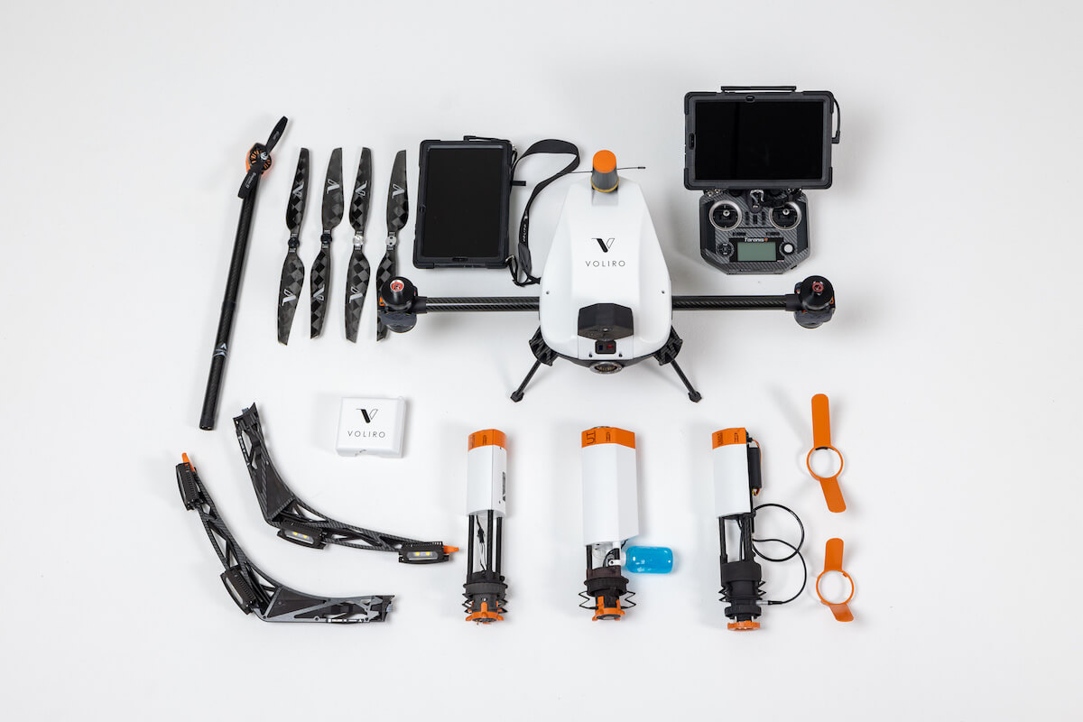
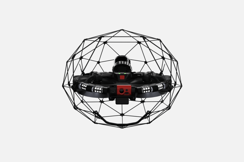
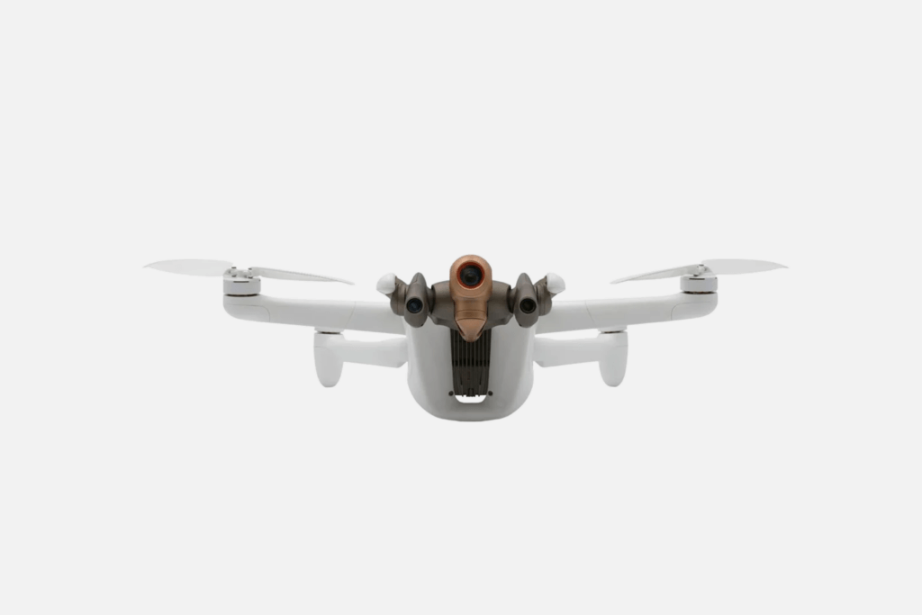
Voliro T (without payload)
Voliro T
Voliro T is an inspection drone, purpose-built for close-to-surface work at height. The drone has four flight modes, including an AI-powered interaction assistant for performing different non-destructive tests. Inspectors can use specialized payloads for ultrasound, EMAT, eddy current, and dry film thickness inspections.
That’s the biggest selection of drone-mounted NDT inspection tools offered by any drone company in one subscription. Pricing also includes a 3-day operator training package, all-risk insurance, part replacements, plus annual hardware rotation.
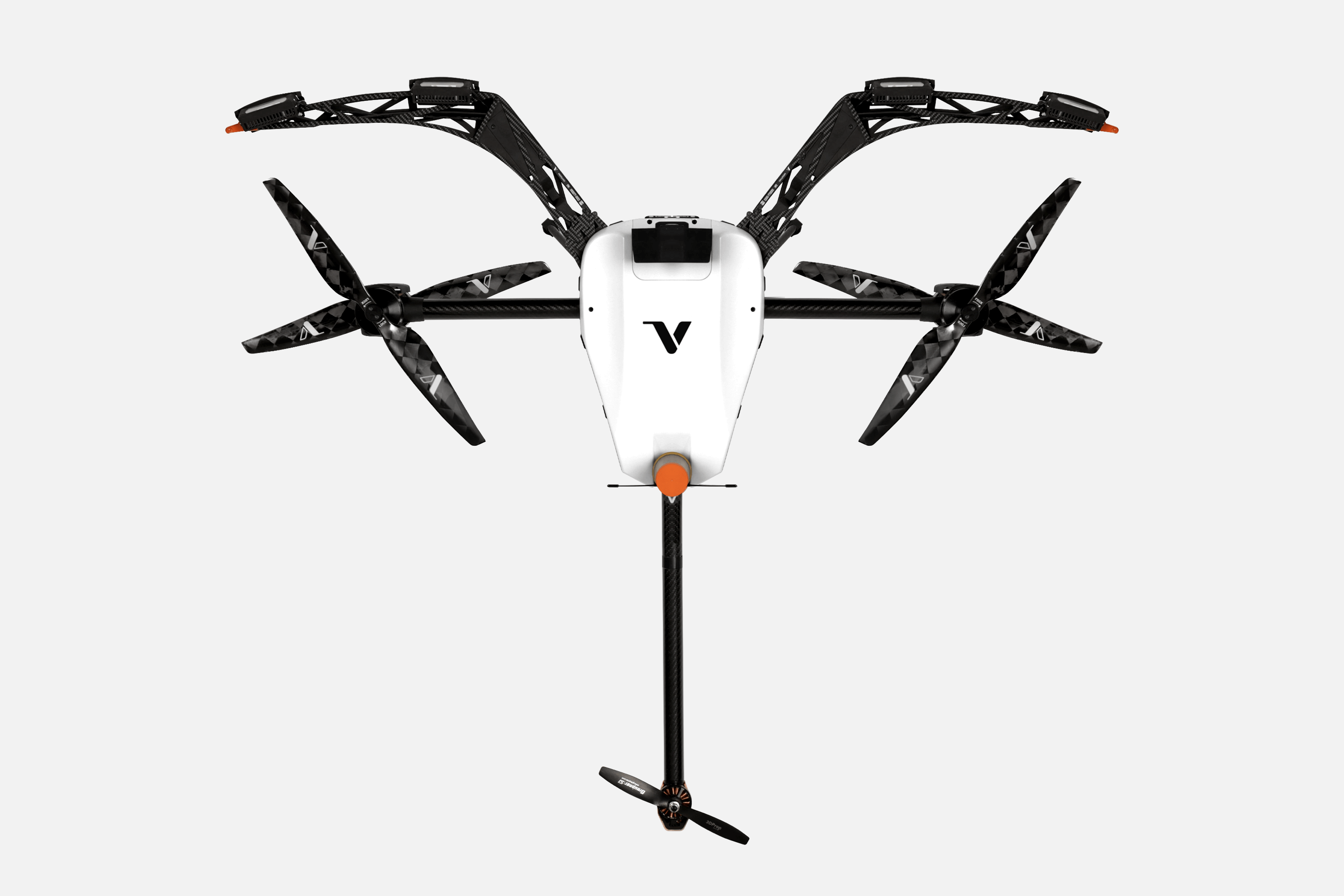
Equipped with a VGA camera, six LiDAR sensors, and six vision-based velocity sensors, the drone boasts high maneuverability. Voliro T has no orientation limitation — you can tilt and interact with it in any direction to inspect complex shapes and narrow cavities. An automation mode helps position the drone at the right angle and auto-fix its position to perform inspection work.
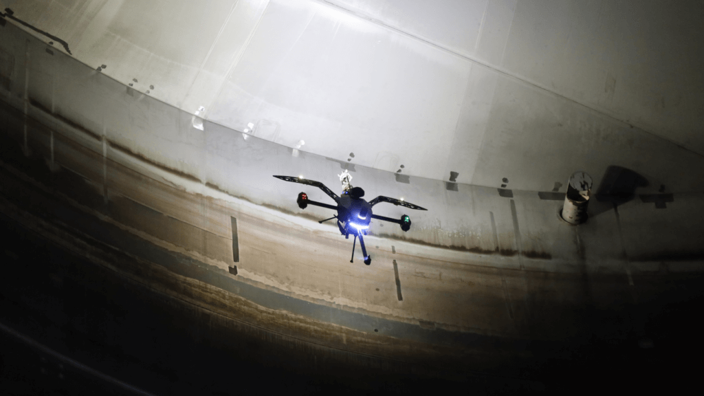
Inside storage tank inspection with Voliro T
Advanced sensing abilities, paired with tiltable rotors and optimized airframe design, enable omnidirectional flight mode and high stability. Voliro T can apply up to 30 N of stable force and several Nm of torque to inspected structures. All the collected data is streamed to a connected inspector tablet in real-time for analysis.
Key Characteristics
4K 12 MP inspector camera2K 12 MP pilot cameraEngineered for contact-based asset inspection
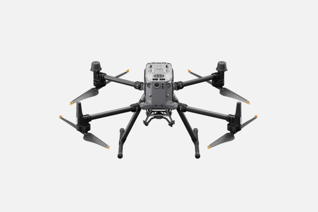
One of the newest releases, DJI Matrice 350 RTK, is designed for commercial use beyond photography. It’s a powerful piece of equipment with a maximum flight time of 55 minutes, wind resistance of 12 m/s, and a payload capacity of 2.7kg.
Matrice 350 RTK can carry up to three payloads on a setup of downward and upward gimbals, including the Zenmuse H20 range from DJI — integrated sensor systems with zoom, wide, and thermal cameras and a laser rangefinder, suitable for high-precision visual asset inspection. Alternatively, you can add custom payloads through DJI Payload SDK.
With the new DJI O3 Enterprise Transmission, users get 1080p HD live feed transmission for up to 20 km in the US and 8 km in the EU. The four-antenna transceiver system selects the best two antennas for transmitting signals and the other two for receiving, leading to significant improvements in anti-interference capabilities.
A six-directional binocular vision system and an infrared sensing system give the Matrice 350 RTK six-directional awareness, advanced positioning, and obstacle detection capabilities for increased safety during the flights.
Key Characteristics
Max flight time: 55 minutes
Payload capacity of 2.7 kg
Wind resistance up to 12 m/s
Li-ion (6500 mAh@7.2 V) battery with optimized charging
Obstacle sensing range of 0.1-8 m
Night-vision first-person view camera
Pros
Strong situational awareness and reliable video transmission
Dustproof and waterproof, operable at temp range of -20° to 50° C (-4° to 122° F)
Ability to add custom payloads to enable extra capabilities
Cons
Higher weight compared to other drones may impact maneuverability in some conditions.
Charging two batteries to 100% takes 60 minutes — longer than some competitors.
Elios 3 is the third generation of Flyability’s confined-space drone model, designed to navigate complex geometries. Meshing SLAM-based stabilization with state-of-the-art computer vision algorithms, Elios 3 can float still even in harsh operating conditions and maneuver through the narrowest cavities. Advanced indoor navigation is supported by a combination of sensors, LIDAR, computer vision, and a 3D visualization engine that creates real-time 3D maps of indoor spaces for high location awareness for pilots, including a real-time 3D view of the drone’s trajectory.
Advanced indoor navigation is supported by sensors, LIDAR, computer vision, and a 3D visualization engine that creates real-time 3D maps for high location awareness, including a real-time 3D view of the drone’s trajectory. Elios 3, however, does require high piloting skills since there isn’t an assisted autonomy flight mode, apart from the return-to-signal feature.
Equipped with a 4K and a thermal camera, Elios 3 helps perform close-up visual asset inspections to detect cracks, pitting, and signs of corrosion. Users can further extend the drone’s capabilities with add-on payloads.
LIDAR Surveyor payload captures spatial data for 3D maps and digital twins with a drift of 0.1% and precision of 6 to 12 mm. RAD Payload measures radiological dose fields on the fly, minimizing workers’ exposure. Both can be used simultaneously, thanks to a dual port payload bay.
Key Characteristics
4k Ultra HD: 3840 x 2160 at 30 fps video recording
FOV 56° x 42° thermal camera
2400 – 2483.5 MHz frequency band
Collision-resistant by design thanks to carbon fiber protection cage
Embedded lighting system with anti-dust mode
Two mountable payloads for surveying and remote radiation detection
Pros
Engineered for complex indoor inspections
Real-time, precise data collection and 3D modeling
High spatial awareness with embedded LIDAR and computer vision camera
Cons
Flight time of under 9 minutes with a payload
No AI-assisted autonomy available
Best Land Surveying and Mapping Drones
Land surveying and asset mapping are two other popular use cases of commercial drones. The best models boast extended flight time of up to 90 minutes to cover large areas within a single flight.
Carrying a variety of photogrammetry payloads, mapping drones can collect HD data at a wide dynamic range for 2D and 3D asset reconstruction (e.g., to create digital twins, perform construction site surveying, or monitor resource extraction in mining).
The next three drones for mapping and surveying can be used for the above and adapted to multiple other use cases.
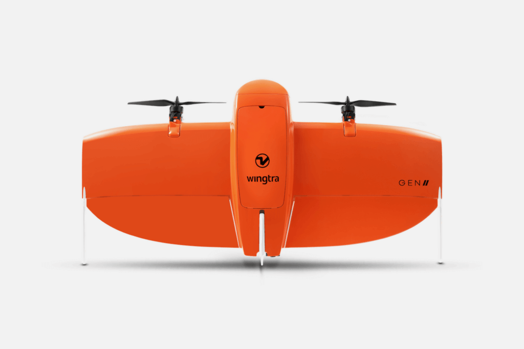
WingtraOne Gen II is a high-accuracy survey and mapping VTOL drone boasting an impressive flight time of up to an hour, subject to the flying conditions and mounted payloads. Boasting an impressive 61 MP camera and robust post-processing capabilities, WingtraOne allows you to cover more area with fewer image overlaps.
You can also easily swap cameras to an RGB, thermal, or multispectral one via a standard USB-C interface. Or try our Wingtra LIDAR — a new terrain mapping mode for scanning beneath vegetation.
Another substantial advantage is best-in-class positional accuracy. During a series of test flights across Switzerland and the US, WingtraOne demonstrated 1 cm (0.4 in) horizontal absolute accuracy with the correct base station configuration.
Helpful mission planning features like autonomous launch and landing, corridor mapping, geofencing, and automatic mission resumption after battery swap help further optimize mapping workflow efficiency. The company claims its drone collects geodata 11X faster flight than other multicopter drones and 2X faster than similar fixed-wing drones. A built-in PPK GNSS antenna from Septentrio and integrated image geotagging software also help ensure accurate geotag correction for map reconstruction, reducing the time in the field.
Key Characteristics
Up to 59 minutes of flight time
10 km (6 mi) telemetry range
Suitable for BVLOS
Includes 2 li-ion 99 Wh smart batteries
Wind resistance up to 18 m/s (40 mph)
Advanced mission planning controls
Pros
Performant design adapted to take off at altitudes of up to 4,800 m (15,700 ft)
Covers up to 310 ha (760 ac) per flight at 120 m (400 ft) altitude above take-off point
Predictive self-healing algorithms notify about potential issues
Cons
Max payload weight capped at 800 gr — lower compared to similar models.
Isn’t water resistant. Not recommended to be used during fog, rain, and snow
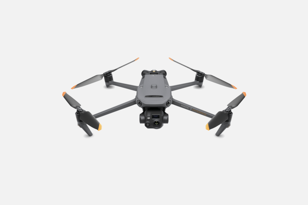
DJI Mavic 3 Enterprise is a strong contender if you’re looking for a compact land surveying drone. Measuring only 347.5 × 283 × 107.7 mm when unfolded, the 3T model boasts truly powerful hardware for photogrammetry.
The 3T model features a wide-angle camera with a focal length of 24 mm and 48 MP resolution, plus a hybrid 56X Max Zoom, enabling ultra-high detail precision. A mechanical shutter allows 0.7-second interval shooting and reduces blur. It also includes a DFOV: 61° 640 × 512 px thermal camera with a focal length of 40 mm, supporting point and area temperature measurement. Thanks to high-temperature alerts, you can easily detect areas of interest — be it heat loss, plant vigor, or human presence. You can simultaneously stream thermal and zoom camera footage side-by-side for more detailed analysis.
Despite its mini size, DJI Mavic Enterprise 3T boasts an impressive flight time of 45 minutes per flight. For greater efficiency, you can program corridor missions to follow highways, pipelines, or river valleys automatically. The mission control app will auto-create the optimal route for effective surveying. The real-time terrain follow feature, powered by vision and infrared sensors, auto-adjusts the drone’s altitude, reducing the risks of collisions.
Key Characteristics
Up to 45 minutes of flight time
Covers up to 2 sq km (494 acres) per mission
Vertical hovering accuracy range of 0.1-05 m
Wide-angle 4/3 CMOS, 20MP camera
Thermal DFOV: 61° 640 × 512 px camera
Omnidirectional sensing
Pros
Excellent performance in low-light conditions with an optimized algorithm
Fast-charge batteries with a 100W charging hub
Omnidirectional obstacle detection and avoidance
Cons
Max wind resistance of 12 m/s due to compact size
Doesn’t offer a Quick Transfer feature on the Enterprise edition.
Evo II RTK Series V3 is an upgrade from an earlier Autel Robotics model with higher-precision positioning, thanks to a new RTK Module. Large propellers and revised flight algorithms also provide a lavish flight time of 38 minutes to support longer surveying missions.
Planning a flight is easy with Autel Explorer software. You can create and save multiple NTRIP profiles for different locations for a faster start and automatically restart the flight from the exact position you’ve finished previously. Other handy features include double-grid mapping, non-stop turning on corners, and customizable course headings to meet orientation requirements. Evo II RTK shoots clean, low-noise visuals in all lighting conditions, thanks to the new 1-inch 6K CMOS image sensor with 20 MP. The adjustable aperture gives further flexibility to adjusting shutter speed control.
Arguably, the biggest advantage of Evo II RTK is its high-res thermal camera and Sony .8″ 50-megapixel RYYB sensor that enables precise infrared measurement at a distance of 2 to 20 meters. The camera includes a 13mm focal length lens and 16x digital zoom, allowing you to capture sharp thermal footage even at a distance. The new image processing algorithm further helps improve the visual quality, plus regulates temperature deviations within 3 degrees Celsius.
Key Characteristics
38 minutes of flight time
1-inch 6K CMOS image sensor with 20 MP
High-resolution thermal camera and Sony .8″ 50-MP RYYB sensor
360-degree obstacle avoidance
27mph max wind resistance
Supports all NTRIP-compatible base stations
Pros
Compact design and fast setup time of under a minute
Shoots in ten different color palettes
Visual data, optimized for post-image processing in different software
Cons
Autel Explorer software is closed-loop, with no developer APIs or SDKs.
The Corridor Flight mission option has been removed from V3
Best Wind Turbine Inspection Drones
Regular inspections are a compliance and safety requirement for wind farm operators. Operators must check blades for cracks and damage, inspect the gearbox for wear, test the lighting protection system, and check bearings for signs of fatigue.
Drones dramatically reduce the costs and complexities of wind turbine inspections. An average inspection takes less than 30 minutes, meaning less operational downtime. By providing real-time data on turbine conditions, drones optimize maintenance schedules and minimize unnecessary servicing, resulting in further cost savings.
Below are our best drone recommendations for wind turbine inspections.
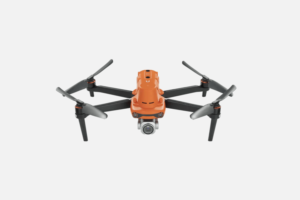
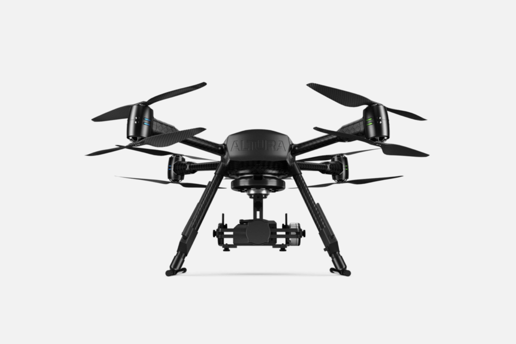
Altura Zenith by Aerialtronics is a high-endurance drone with an IPX5 rating for water resistance. Eight motors and redundant Inertial Measurement Unit (IMU) sensors provide extra protection for harsh conditions like offshore wind farms.
By design, Altura Zenith ATX8 is compatible with 35+ sensors and payloads, securely hoisted in an Altura Cardan — a durable gimbal adaptor. These include OEM-supplied and third-party tools, from HD cameras to thermal sensors and VOC monitors. The drone sustains a max payload of 3 kg.
Aerialtronics offers Pensar, a mountable dual-spectrum computer vision platform for inspections. It combines a built-in Sony 30X zoom camera and FLIR Boson camera to capture heat signatures and visual defects like dents, cracks, and corrosion on blades and pylons. Video and thermal screens are synched with an onboard AI-powered sensor fusion unit. The streamed video can be instantly uploaded to the cloud, too.
Key Characteristics
40-minute flight time
Payload up to 3 kg
Range up to 1 km
Operable in heavy rain, snow, or dust
Includes redundant IMUs and motors for extra safety
Compatible with 35+ sensors
Pros
Combines video and thermal data for enhanced inspections.
Automatic flight mode for executing repeatable flight plans
Real-time object detection and labeling with embedded AI algorithms.
Cons
Camera gear must be purchased separately.
Relies heavily on GPS and struggles in GPS-denied environments.
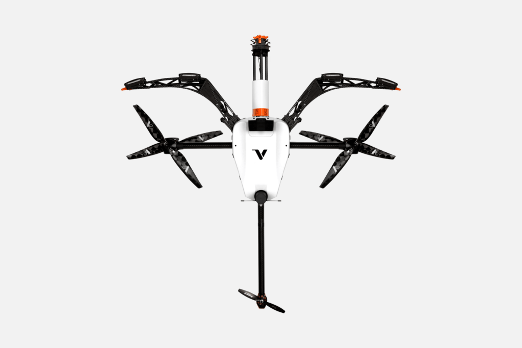
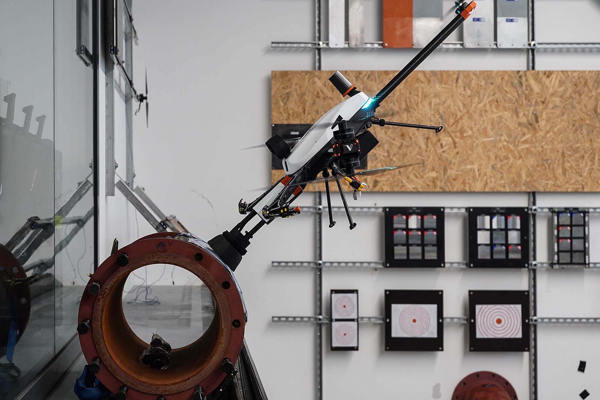
Voliro T (with payload)
Voliro T
Voliro created a specialized drone-mounted lightning protection system (LPS) test probe, designed for full circuit resistance measurements. Using the Voliro T drone, pilots establish an electrical connection with the lightning receptors to test system components for electrical resistance. The probe complies with EN 62305-3, can apply a 30 N force, and supports a maximum voltage of 24 V.
With our LPS kit, inspections require one rotor stop and take 20-30 minutes on average. Our customers inspect 8 to 18 turbines per day — a much greater efficiency compared to conventional methods.
In addition, Voliro drones can be used for other types of inspections, including ultrasonic and pulsed eddy current tests for defects or discontinuities with interchangeable probes.
Key Characteristics
20-30 minutes LPS inspection time
1 person operation
1 stop inspection in any rotor orientation
250 meters inspection height
No access to the hub or nacelle required
Extra payloads for UT and eddy current testing
Pros
Stable, high-precision inspection, done in 20-30 minutes
LPS tests can be done in any rotor orientation
One solution for different types of inspections
Cons
Multiple takeoffs may be required due to limited battery capacity
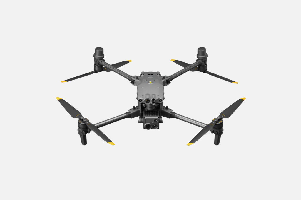
DJI Matrice 30 is a sturdy enterprise drone, proven to work well even in adverse weather and below sub-zero temperatures, thanks to IP55 protection. So, it’s a good option to consider for offshore wind farm inspections.
The built-in redundancy systems, including a dual inertial measurement unit, dual barometer, RTK Antennas + GNSS Module, and dual battery power supply, among other “doubles”, add a further layer of reliability. Six pairs of vision sensors and six infrared ToF sensors also lend Matrice 30 a comfortable obstacle-sensing range of 0.5-38 meters in every direction.
Otherwise, you have the traditionally great camera system featuring a 48M Zoom and a 12M wide-angle camera for collecting asset condition data.
Key Characteristics
41 minutes max flight time
12 m/s wind resistance
12 MP 1/2” CMOS Sensor wide camera
48 MP 1/2” CMOS Sensor zoom camera
Li-ion 6S 5880 mAh dual battery system
Auxiliary lights with 5 m illumination distance
Pros
Redundancy and backup systems eliminate the possibility of hardware failure
Triple-channel 1080p video transmission with minuscule latency
FPV camera, optimized to fly in low light conditions
Cons
Hypersensitive obstacle avoidance system
Doesn’t offer specialized inspection payloads
Best Cell Tower Inspection Drones
Inspecting cell towers is a complex and demanding task that requires a lot of resources and entails significant risk to personnel. Inspectors must frequently check tower structure, electrical and lighting systems, antennas, anchors, and transmission lines for signs of damage, degradation, and wear.
By minimizing the need for specialized equipment and labor, drones make cell tower inspection more cost-effective and comprehensive. You can detect overheating equipment with thermal signatures, find tiny cracks with HD snaps, and collect spatial data for 3D asset reconstruction.
Below are our top rec drones for cell tower and telecom asset inspection.
Skydio X10 is one of the best commercial drones in terms of footage quality. You get not one, not two, but three cameras: Sony 1/1.7″ 64MP narrow, Sony IMX989 1″ 50.3MP wide, and Teledyne Flir Boson+ thermal camera.
The trifecta gives Skydio enviable shooting capabilities in sharpness, dynamic range, and signal-to-noise ratio. Skydio X10 can capture 0.1 mm cracks on photos and has thermal sensitivity down to under 30 mK. That’s handy for early detection of structural damage or electrical faults in telecom assets.
Skydio 3D scan app facilitates data collection through autonomous 2D or 3D scan flight modes. The app auto-builds flight routes of complex surfaces using contour-hugging motion planning. Specialized Tour Scanning mode is already included. You can generate models in the app or export data to platforms like Pix4D, DroneDeploy, or ESRI SiteScan.
An 8419 mAh Lithium Ion Polymer battery supports up to 40 minutes of flight time, subject to operating conditions. An in-built obstacle avoidance system, powered by AI, ensures high flight stability, even close to antennas. Skydio X10 glides seamlessly even in high EMI environments, thanks to a predictive AI algorithm trained on nearly a decade of flying hours.
Key Characteristics
Flight time up to 40 minutes
Three-camera setup
Built-in obstacle avoidance
Hoovering accuracy of 10 cm
Max tilt angle of 40 degrees
Wireless/LTE/5G connectivity
Pros
360-degree visibility with 6 navigation lenses, offering stellar spatial awareness
Operates in GPS-denied or high EMI environments with AI flight assistance
3D Tower Capture feature provides optimized settings for scanning vertical structures
Cons
No option to change the default obstacle avoidance sensitivity
Max takeoff weight capped at 2.49 kg, excluding additional payloads.
DJI Mavic 3 Enterprise Series is truly an all-purpose workhorse. Apart from land surveying missions, its 3E model is a cost-effective, portable option for telecom asset inspection. Unlike the 3T model, the 3E only includes a wide-angle 20 MP camera, but it’s more than enough to capture sharp images, even when cruising at high speeds.
The Smart Oblique Capture feature also comes in handy as it automatically rotates the gimbal in three directions — front, middle, and back — allowing data capture for 3D modeling. A flight time of 30 to 45 minutes, subject to weather conditions, allows you to scan several cell towers during one mission,
On the maneuverability side, the Mavic 3E boasts 360-degree obstacle avoidance. With a dual vision and infrared setup, Mavic 3E can detect obstacles at 0.5-20 m range when moving forward, 0.5-25 m for backward motions, and 0.3m-25 m in all other directions. You can also customize proximity alerts and braking distances to better suit the mission.
Key Characteristics
Up to 45 minutes of flight time
Wide-angle 4/3 CMOS, 20 MP camera
H.264/4K/FHD video resolution
Max flight speed of 21 m/s forward, 20 m/s side and, 19 m/s backward
Vertical hovering accuracy of 0.1 m
Automatic return-to-home, optimizing battery life
Pros
Max transmission distance of 8km-15km, subject to regulations
Automatic obstacle rerouting and reliable collision prevention
ANAFI Ai is one of the best enterprise drones for autonomous photogrammetry. A 48 MP 1/2” CMOS sensor with a Quad Bayer color filter pattern provides sharpness for identifying minuscule details. ANAFI Ai captures detailed images with a wide dynamic range, delivering 55% more detail than standard 2D/3D reconstructions.
FreeFlight 7 pilot app includes three photogrammetry flight modes: Grid, double-grid, and circular missions. ANAFI Ai sensors (IMU, GNSS & ToF) determine the optimal flight parameters for 3D reconstruction. The system is also pre-trained to recognize certain types of assets. For example, cell tower features and extract their dimensions (height, down-tilt, azimuth, etc.).
The ANAFI Ai flight controller offers an intuitive and user-friendly piloting experience, requiring no prior training. Sensor fusion algorithms combine data from all sensors to estimate the drone’s attitude, altitude, position, and velocity, allowing for automated flight modes. The onboard omnidirectional sensing system, based on stereoscopic vision, also orients the drone’s movement and helps avoid obstacles.
Key Characteristics
Flight time: 32 minutes
4K UHD video with 24/25/30 fps
Shutter speed: 1 s to 1/10,000 s
6x lossless zoom, up to 4x (1080p) & 2x (4K UHD)
6-axis stabilization for mounted camera
Advance AI-assisted autonomy
Pros
One-click flight plan creation for different missions missions
Compatible with popular PIX4D software suite
Uses RGB sensors over LIDAR to deliver photorealistic renderings
Cons
Lower flight time, compared to other drones
Moderate flying speed, limiting coverage within one mission
Best Inspection Drones: Comparison Table
Model
Avg. flight time
Mobility
Autonomy
Payloads
Pilot training
Top use cases
Voliro T
10-15 min
360-degree (in any direction)
AI-powered interaction assistant for contact-based work
Ultrasonic transducer
EMAT
Dry Film Thickness gauge
LPS tester
Pulsed eddy current wall thickness measurement tool
✅ Included in the subscription
Non-destructive testing of industrial assets
Storage tank inspection
LPS testing at wind farms
Wall thickness and protective coating measurements
WingtraOne
59 min
In six directions
Automated launch, landing, and mission plan following with the ability to overtake controls.
Sony RGB Cameras
RGB Oblique Sony ɑ6100
LIDAR sensor
MicaSense mulispector sensor
✅ Available online and on-site
Autonomous photogrammetry
Land surveying
3D asset modeling
Orthophotography
Altura Zenith ATX8
40 min
In six directions
Design and pre-program automated flight paths via Altura GCS app
Pensar computer vision system
Sony Alpha camera range
VOC monitors
Custom payloads
❌ None available
Wind farm inspection
Surveillance operations
Accident mapping
Volumetric measurements
Skydio X10
40 min
In six directions
15 software-enabled autonomy features
❌ None available
✅ Online training academy
Cell tower inspections
Distribution network inspections
Site security
Construction site monitoring
Discover Voliro Inspection Drones
If you’re looking for a versatile inspection drone, Voliro is the best choice. One omnidirectional drone can cover a variety of use cases and asset types: from visual external inspections of flare chimneys to crack detection in chemical storage tanks using ultrasound.
With a subscription model, you can seamlessly switch between payloads, get access to the latest product updates, and avoid the risks of obsolete, expensive tech. Redefine your inspection process with Voliro.