Guide to Drone Payloads: Types, Use Cases, Best Recommendations
Table of Contents
1.
What is a Drone Payload?
2.
How Much Weight Can a Drone Carry?
2.1.
Factors that Affect Drone Payload Capacity
2.2.
Is it Possible to Increase Drone Payload Capacity?
3.
Popular Types of Drone Payloads
3.1.
RGB Cameras
3.2.
Infrared and Thermal Cameras
3.3.
Ultrasonic Probes
3.4.
Multispectral Sensors
3.5.
Gas Detectors
3.6.
Dry Film Thickness Gauges
3.7.
LIDAR Systems
3.8.
Magnetometers
3.9.
Lighting Protection System (LPS) Testing Tools
3.10.
Radiation Sensors
3.11.
Other Types of Drone Payloads
4.
Things to Consider When Choosing a Drone Payload
Drones are as versatile as a Swiss Army knife in a survival kit. The same model can survey new construction sites, monitor industrial pipes’ heat signatures, and detect cracks in concrete storage tanks.
How can the same copter serve so many purposes? Thanks to drone payloads.
What is a Drone Payload?
A drone payload is the extra weight an unmanned aerial vehicle (UAV) can carry — cameras, sensors, or other cargo. Hoisted to the drone’s body and remotely controlled via the piloting app, payloads extend the range of tasks a drone can perform.
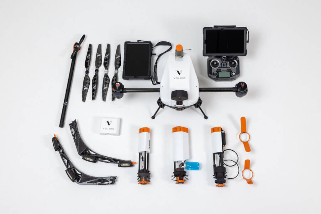
Voliro T inspection drone with compatible payloads
Commercial drones come with mounts, brackets, or gimbals to snuggly fit the payload and connection cables. On-board programmable controllers, in turn, enable connectivity between the drone, the payload, and the controller app for easy management.
Some payload architectures are closed-source, while others are open-source, allowing for custom controls using the provided SDK. For example, DJI provides a Payload SDK for most enterprise models, enabling integration of third-party payloads with the drone hardware for additional functionality such as extra gimbal controls, navigation features, or positioning precision.
Likewise, drone manufacturers can accommodate changes to the payload dock to integrate third-party payloads. Voliro has an open payload architecture for additional payloads, beyond our current range of non-destructive testing tools. Other companies don’t support such customizations. Consider this when choosing an enterprise drone.
How Much Weight Can a Drone Carry?
A commercial drone can lift anywhere between 150 gr/5 oz to 30kg/67 lbs in payload capacity, determined by its size, power, and flight characteristics.
Factors that Affect Drone Payload Capacity
Structural design. The size and shape of the frame affect drone payload capacity, as does the frame material. Fixed-wing drones have stronger structures to support bulkier payloads.
Motor configuration. Drones with more motors like hexacopters and octocopters can distribute the load better, hence lifting heavier cargo. Motor placement also ensures more balanced lift and stability during flight.
Thrust. Enterprise drones have a higher payload capacity due to the extra thrust they can deliver from rotor size and body configuration.
Power system: Bigger batteries equal greater lifting power (and longer flight time). Some industrial drones also feature hybrid electric/gasoline powertrains, which add extra lifting power.
Don’t forget: There’s a direct correlation between a drone’s lifting capacity and its maneuverability. Each drone has a specific center of gravity for stability and performance. Mounted payloads shift the center of gravity, altering the drone’s operation on the three axes (pitch, yaw, and roll). Native payloads usually account for this, but third-party ones may affect the drone’s performance.
Large Payload Drones
Model
Payload Capacity
Max flight Time
Draganfly Heavy Lift Drone
67 lbs / 30.kg
55 minutes
Hercules 20
33 lbs / 15 kg
40 minutes
Perimeter 8 UAV
22 lbs / 10 kg
5+ hours, thanks to an internal combustion two stroke engine
IF1200
19.1lbs / 8.6 kg
43 minutes
Is it Possible to Increase Drone Payload Capacity?
Technically, yes. If you can increase the drone’s power and thrust, you can increase its payload capacity. In practice, however, that would require extensive airframe, rotor, and propeller customization. Subsequent performance testing is also needed. So it may be better to choose a high payload drone from the get-go.
Popular Types of Drone Payloads
The drone payload market is full to the brim with some great native and third-party options.
Native payloads are custom-built by the drone manufacturer to optimally fit with a particular drone model(s). Some are natively embedded (e.g., camera systems). Others are mountable and interchangeable (e.g., several different ultrasonic probes).
Drone-compatible tools and accessories developed by someone other than the drone manufacturer are called third-party payloads. They can be hoisted to a payload drone but may need customization and integration for proper controls.
Here are some of the very best drone payloads in the next categories:
RGB cameras
Thermal cameras
Ultrasonic probes
Multispectral sensors
Gas detectors
DFT gauges
LiDAR systems
Magnetometers
Lighting protection system testers
Radiation sensors
RGB Cameras
The best drones come equipped with top-of-the-line color cameras. Depending on the use case, models can have HD visual inspection cameras, multifocal photogrammetry cameras, and wide-angle lenses for land surveying.
The latest drone models feature cameras with Complementary Metal-Oxide Semiconductor (CMOS) sensors. Thanks to on-chip processing and individual pixel readouts, CMOS sensors have lower power consumption, lending extended drone flight time. They also offer faster image capture and readout speeds, wider dynamic range, greater sharpness, and a higher frame rate.
Moreover, CMOS allows for easy integration of extra circuitry on the sensor chip, such as amplifiers, noise reduction, or Bayesian filters for better footage quality. ANAFI Ai drone, for example, embeds a 48 MP 1/2” CMOS sensor, equipped with a Quad Bayer color filter pattern, for higher-definition images and a wider dynamic range.
ANAFI Ai lens with 6 aspherical elements, optimized for low optical flare. Source: Parrot
Zoom range is another important characteristic of drone cameras. If you plan to use drones for asset integrity inspection, look for models with a hybrid zoom camera, combining optical and digital zoom mechanisms for range extension. 10X to 20X zoom is pretty standard.
The best inspection drones like DJI Mavic 3 Enterprise boast 56X zoom. For a sharper image, look for drone cameras with a larger sensor size (e.g., 1-inch, APS-C) as it offers better low-light performance and dynamic range. Features like larger apertures (e.g., f/2.8 or lower) and high ISO sensitivity also improve footage capture in low-light conditions.
Overall, there’s no shortage of native and third-party camera systems for drones, so the choice boils down to the specs you need.
Infrared and Thermal Cameras
Electro-optical (EO)/Infrared (IR) camera payloads are another popular add-on. Thermal imaging is useful in search and rescue and drone patrolling missions to quickly detect human presence. Thermal drones also aid in firefighting and environmental monitoring.
In asset management, EO/IR systems help detect temperature variations, indicative of damage, wear, or performance anomalies. Thermal drone power line inspection helps identify overheated lines and components or detect abnormal heat patterns in transformers — both indicative of impending failure.
Anomalies in heat signatures can also indicate blockages in heat exchangers and industrial boilers. In the oil and gas sector, thermal drones aid in pipeline inspection for substance leaks. Skydio X10, for example, features an embedded FLIR Boson sensor and CMOS-based imaging gear, providing radiometric readings at a sensitivity of just under 30 mK.
DJI Zenmuse H20T is another popular payload choice, combining a 20 MP zoom camera, 12 MP Wide Camera, 1200 m laser rangefinder, and a 640×512 px radiometric thermal camera. Moreover, you can find excellent thermal drone cameras from Gremsy. The new VIO system combines a 640×512 radiometric thermal camera, a 4K zoom sensor, and an integrated 2400m laser rangefinder.
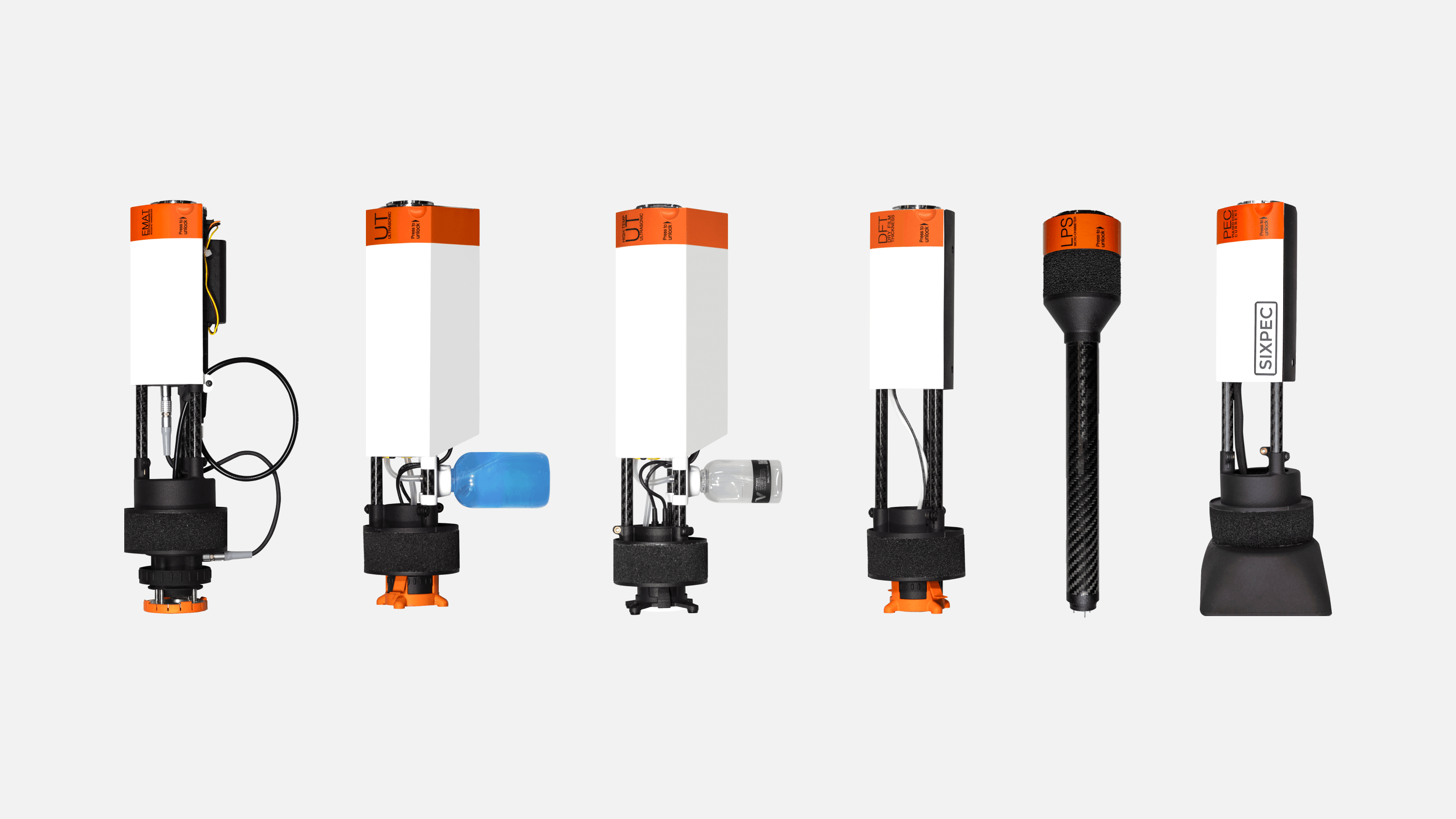
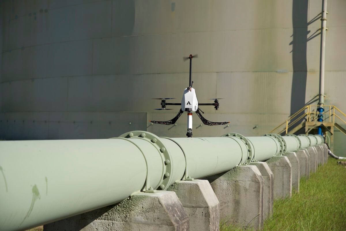
Ultrasonic Probes
Traditionally, NDT came with a baggage of logistical and staging challenges for ensuring easy physical access to the test structure. To the point when the preparation itself exceeded the cost of doing an inspection.
Specialized non-destructive testing (NDT) drones like Voliro T eliminate the need for scaffolding or lifting equipment for asset testing. Engineered for six-axis movement, the Voliro tricopter can safely hover close to structures and apply 30 N of stable force and several Nm of torque to perform point-to-point tests with drone-adapted ultrasonic testing probes.
Our payload range includes:
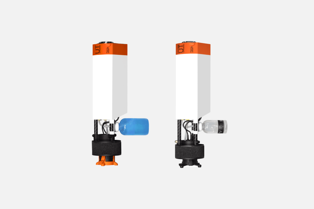
Ultrasonic transducer (UT) with Echo-to-Echo and Pulsed Echo for taking wall thickness measurements with a resolution of 0.02 us (0.06 mm at 5900 m/s). It also has a convenient couplant applicator.
High-temperature UT payload has the same characteristics but was hardened to work at up to 260 °C/500 °F temperature range to collect readings on assets in use (e.g., detect corrosion on an active flare stack).
Electromagnetic Acoustic Transducer (EMAT) thickness gauge provides a measurement range of 2-150 mm on corroded and dirty surfaces, where couplant application is challenging.
With Voliro T NDT payloads, inspection teams spend 2X-4X less time on asset inspection, collecting twice as much data. Mistras Group inspected a 180 ft flare stack inspection in less than two hours, collecting over 200 thickness measurements. In another case, Bilfingers saved its client over $165,000 in operational costs (labor, scaffolding, and equipment) with Voliro, completing a stack inspection in just 1.5 days instead of the standard 25 days.
Multispectral sensors are of tremendous use in precision agriculture and environmental monitoring. Drones cover more ground in less time than foot or vehicle patrols. Plus cost less than chartered planes. With multispectral sensor payloads, you can capture vegetation index data frequently to identify stressed areas due to pests, diseases, or water deficiency.
Likewise, multispectral cameras help capture spectral signatures of potential mineral deposits and map terrain features. On active sites, multispectral drones help assess environmental impacts and monitor stockpile management efficiency to avoid accidents.
When shopping for multispectral cameras for drones, consider the number of supported spectral banks, wavelengths, and bandwidths. Models with high spectral and spatial resolution also provide sharper images with less distortion. A dynamic sensor range allows for capturing better visuals in poor lighting. Lastly, a global shutter prevents motion blur on video.
Some of the best multispectral sensors for drones are:
Senetra 6X Multispectral. The light-weight (just 250 gr/8.8oz!) sensor combines five 3.2MP global shutter multispectral imagers and one 20MP RGB imager all in one.
RedEdge-P. An NDAA compliant system with five narrow multispectral bands with scientific-grade filters and output resolutions of 2 cm / 0.8 in at 60 m / 200 ft.
MicaSense Altum. A combo of 12 MP high-resolution panchromatic sensor and Boson 320 x 256 33.5 cm/pixel thermal sensor.
Gas Detectors
The best drones for the oil and gas sector have embedded or mountable gas sniffers. Inspection drones can be easily furnished with electrochemical sensors for carbon monoxide, nitrogen dioxide, and hydrogen sulfide detection or infrared sensors for monitoring IR light absorption.
Although, if you want more precise measurements for sustainability reporting, for example, a laser-based gas detector may be a better choice. The latest models use absorption spectroscopy to identify and measure gas concentration. Tunable Diode Laser Absorption Spectroscopy (TDLAS) can detect even the lowest gas concentrations with high precision and at a longer distance than other methods.
The gas detection payloads we recommend:
FLIR MUVE C360. Mountable multi-gas detector (CO, Cl2, O2, NO2, H2 S, SO2, LEL), with an integrated snorkel, extending past the propellers to sample the unperturbed air. Remote controlled via USB-A accessory (tablet) and UAS power port and serial (C360).
Laser Falcon Methane Detector. A Class 2 laser for detecting methane and methane-containing gasses up to 60 m/100ft. Offers automatic GPS time synchronization for report generation (time, leak concentration, GPS coordinates, etc).
U10 Methane Detector. A methane detector, based on TDLAS, detects gas presence at up to 100 m/329 ft at a concentration below 5ppm.m.
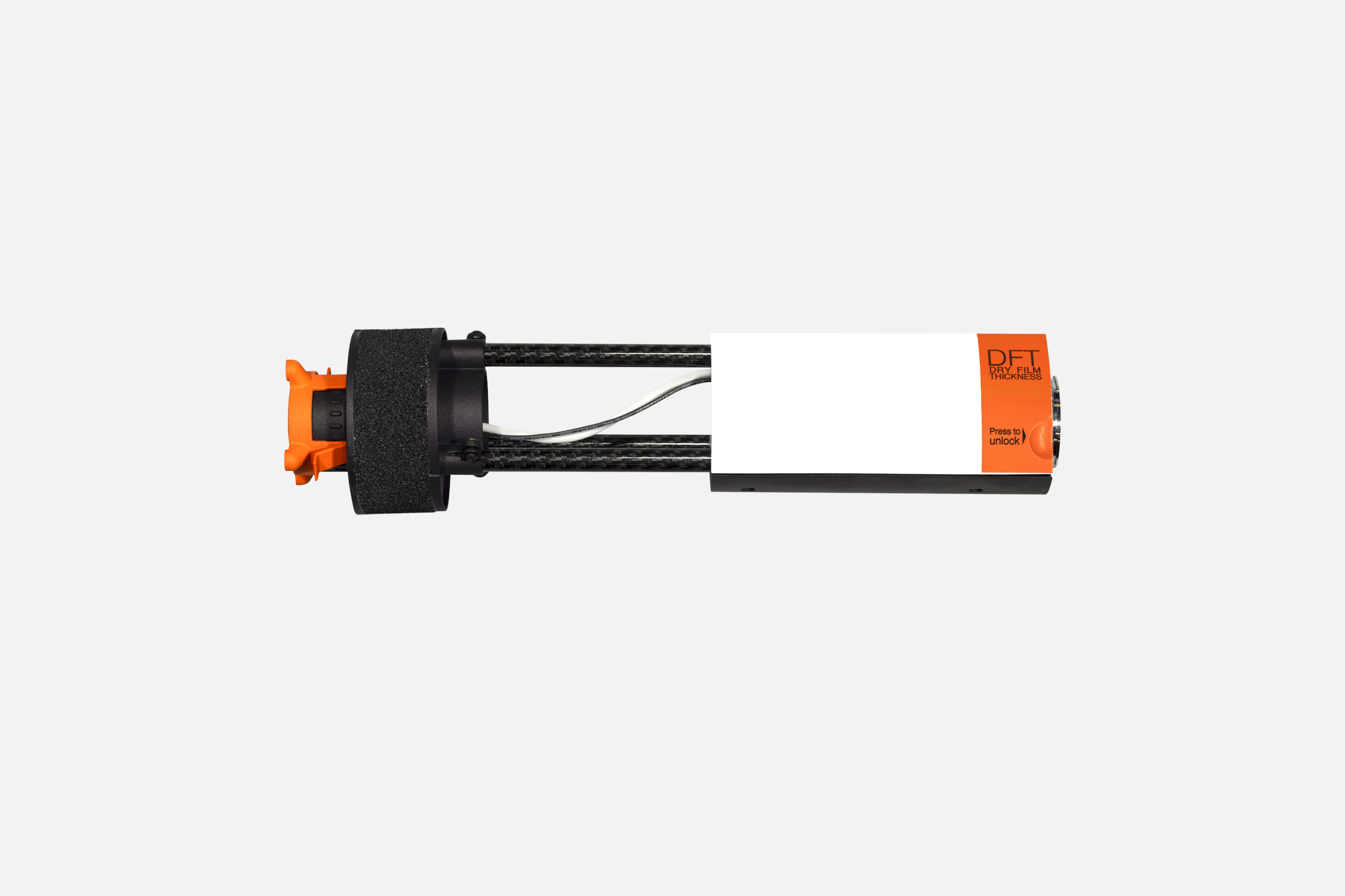
Dry Film Thickness Gauges
Regular protective coating inspections are critical for preventing corrosion on metal structures, leaks in storage tanks, and general degradation. Proper application and timely re-coating are a compliance requirement across industries.
Traditionally, digital DFT gauges are hand-held (like the trusted Elcometer equipment), so inspectors had to climb up to take measurements. Voliro’s solution allows teams to stay on the ground while collecting high-fidelity spot measurements.
Our DFT probe, compliant with applicable EN ISO and ASTM B standards, features a dual measurement mode of 0-1500 um for magnetic induction and 0-700 um for eddy testing. The measurement range is 0 – 1.5 mm / 0 – 60 mils and 0 – 0.7 mm / 0 – 30 mils respectively.
Voliro’s omnidirectional freedom and high situational awareness allow a safe approach to inspecting coatings before they dry. EnerTrans inspected 10+ transmission towers in one day with a smaller team, right after the coating application, saving time on repeat visits and equipment commissioning.
Voliro DFT probe for inspection drones
LIDAR Systems
Light detection and ranging (LiDAR) systems provide more positional accuracy for asset photogrammetry and land surveying with drones. Traditional photogrammetry relies on an RGB camera to capture a consecutive array of photos for 2D/3D modeling. This approach may miss finer details like power lines or terrain features under vegetation.
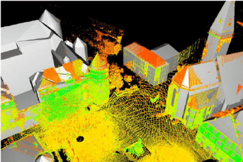
LiDAR systems use laser pulses to map assets. Distance data combined with the sensor’s position and orientation (supplied by GPS and IMU) determines the reflection point of each laser pulse. Combined, individual points create a high-density point cloud — a model of the 3D space.
Sample 3D point cloud of a city. Source: ResearchGate
Unlike photogrammetry, which relies on image matching and triangulation to infer distances, LiDAR provides high-fidelity distance measurements for higher model accuracy. There’s also lower dependency on lighting conditions. LiDAR mapping can be done at night, in high-contrast lighting, or on uniform surfaces lacking distinct features like unicolored sand dunes.
However, LiDAR models lack the photorealism of photogrammetry models. That’s why many drone companies combine RGB and LiDAR into one sensing system. DJI Zenmuse L2 payload integrates a Livox LIDAR sensor, a high-accuracy IMU, and a 20MP 4/3 CMOS RGB mapping camera. The system can detect objects from 250 m/ 820 ft at 10% reflectivity and 100 klx, and up to 450 m/ 1480f at 50% reflectivity and 0 klx.
YellowScan also has a great lineup of drone-compatible LiDAR systems. Voyager is a popular choice, operating at up to 440m/1444 ft with a precision of 0.5 cm/ 0.2 in and a centimeter-level accuracy range. It’s also compatible with a range of RGB cameras. Surveyor Ultra is a light-weight, more affordable option, offering 3 cm / 1,2 inch precision and 2.5 cm /1 inch accuracy at altitudes up to 140 m/460 ft.
Magnetometers
Drone-mounted magnetometers bring greater depth to ground surveying (pun intended). By measuring magnetic fields, you can detect buried pipelines and underground utilities during construction.
Or identify promising exploration sites for exploitation. MWH Geo-Surveys deployed UAVs with magnetometer payloads in almost every corner of the world — from the Andes to the Arabian Peninsula — to perform mineral exploitation surveys. In total, the company created detailed orthophoto and DSM maps covering over 8,000 square kilometers.
The team prefers working with laser-pumped Cesium vapor magnetometers for drones as they boast the highest sensitivity, top precision, and real-time data acquisition in dynamic environments. And they don’t require a physical surface with the measured area, meaning you can hover the drone at a higher altitude to avoid collisions.
Quantum magnetometers for drones are also a new gizmo, being developed by a CanadianSBQuantum. The team is working on a drone-compatible magnetic device, powered byquantum impurities and diamonds. The sensor’s core is a lab-grown diamond, containing carbon and nitrogen to give it spin, essentially making it an extremely small magnet. The amplitude and direction of its magnetic field measurements provide high accuracy with no zero spots.
That said, you still have a host of excellent traditional magnetometers for drones like:
MagArrow. Self-contained magnetometer system, featuring a light-weight protective shell with MFAM magnetic sensors, GPS, and IMU. The MFAM, a two-sensor module, has an impressive sensitivity range of 0.005nT/√Hzrms and an operating range of 20,000nT to 100,000nT.
MagNIMBUS. QuSpin QTFM Gen-2 atomic total-field magnetometer sensors, placed on a mechanical self-retracting arm for operating very close to the ground.
MagDrone R3. A kit featuring a sensor tube with two built-in 3-axis Fluxgates (150pT resolution each), a data logger with an internal SD card, rechargeable batteries, and an integrated GPS. Requires a drone payload capacity of at least 1 kg/2.2 lbs.
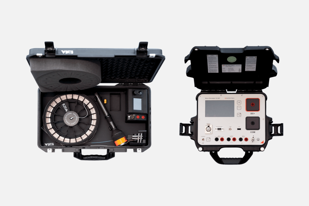
Lighting Protection System (LPS) Testing Tools
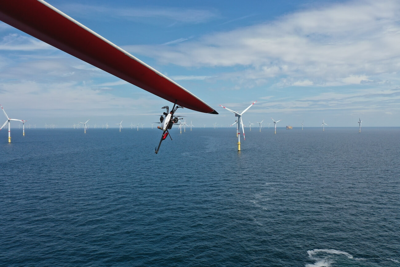
Lighting protection systems (LPS) prevent billions of potential damages annually…as long as they function well. Traditionally, LPS testing requires rope access or lifting platform construction, leading to prolonged downtime, especially on wind turbines. A drone with a payload can eliminate those issues.
Voliro T with an LPS testing probe reduces the inspection time to 20-30 minutes on average. In the case of wind turbines, the rotor can be stopped in any orientation. Voliro’s angular, EN 62305-3 LPS probe can connect with oxidized lightning receptors for measurements at height. The measurement current is 0.30 A (for resistances <20 Ω).
With Voliro, Skyspecs, a renewable energy asset management company, inspects 10-12 wind turbines per day with smaller crews. Our high-precision LPS probe detects 3X-4X more defects, leading to better wind turbine maintenance.
Voliro LPS testing kit for drones
Radiation Sensors
Operational safety is critical in industries handling naturally occurring radioactive materials (NORM) and their byproducts. Drone-mounted radiation sensors enable remote dose field measurement and monitoring at nuclear, mining, chemical, and waste management facilities. By using drones to detect and map radiation hot spots, teams can better plan interventions and minimize human exposure.
Likewise, drones are useful for decommissioning surveys at former nuclear sites or areas with radiological materials. Sellafield, a former UK nuclear site, uses Elios drones with a radiation detection payload to survey and 3D map all above and underground structures (counting 1000 buildings) before allowing personnel entry.
Some other excellent radiation sensors for drones are:
Kromek SIGMA 25/50. A lightweight model with a gamma detection volume of 32.8cm3 / 2 in3 and an output of 54 photons/keV. TN15 is another great model for Neutron detection that doesn’t require cooling and can operate at room temperature.
SPIR-Explorer sensor. Combines two scintillator detectors for radiation, delivering a dose measurement range of 0,001 µSv/h to 10 Sv/h (0,1 µR/h to 1000 R/h). Also offers real-time nuclide identification and count rate for each nuclide.
Other Types of Drone Payloads
Apart from the above, drones can be also furnished with other payloads like:
Delivery systems like baskets, droppers, and boxes with drop-off mechanisms for commercial deliveries or medical supplies distribution.
Agriculture payloads, including crop sprayers, fertilizer spreaders, and seed dispensers, plus crop health monitoring sensors (e.g., hyperspectral or near-infrared sensors).
Communication equipment likeradio relays and mobile network extenders, mounted to tethered drones to extend connectivity in remote areas.
Public safety tools like floodlights, loudspeakers, emergency beacons, smoke detectors, or explosives prevention sensors, designed to sniff hazardous materials.
Things to Consider When Choosing a Drone Payload
To select the best gear on the market, consider:
Primary use case. Determine key hardware requirements for your application (e.g., HD video footage, thermal sensitivity, ultrasonic testing). Compare payload characteristics such as resolution, accuracy, detection range, etc.
Compatibility. Ensure the payload fits with the drone mounting system and control interfaces.
Weight. Don’t go beyond the manufacturer-recommended payload weight limit to avoid performance issues.
Power requirements. Verify that the drone can supply adequate power to the payload without risking battery drainage.
Durability. Choose rugged, temperature and weather-resistant payloads if the use case calls for that.
Data handling. Check that the payload supports data streaming and/or has sufficient onboard storage. Ensure your analytics software is compatible with payload data format(s).
Training. More advanced payload systems may require extra pilot training. Go for options with sufficient tech documentation and training support options.
In most cases, it’s worth going with the payload tools offered by the drone manufacturer. You’re less likely to run into compatibility issues and will get better support. Voliro, for example, includes access to all drone payloads (and all upcoming releases) into one product subscription, with all-cover insurance, pilot training, spare parts, and maintenance to boot.