Enterprise Drones: Characteristics, Use Cases, Best Models
Table of Contents
1.
Enterprise vs Consumer Drones: What are The Differences?
1.1.
Extended Flight Time
1.2.
Specialized Payloads
1.3.
Rugged Design
1.4.
Advance Navigation Features
2.
Top Enterprise Drone Use Cases
2.1.
Visual Asset Inspection
2.2.
Non-Destructive Testing
2.3.
Mapping and Surveying
2.4.
Public Safety and Site Security
2.5.
Environmental Monitoring
3.
Best Enterprise Drones on the Market
3.1.
Voliro
3.2.
DJI Matrice 350 RTK
3.3.
Skydio X10
3.4.
WingtraOne
3.5.
Elios 3
4.
Discover More Enterprise Drones
In about two decades, drones moved from being a sparsely deployed military technology to a staple in the commercial sector.
From real estate videography to large industrial asset inspections, enterprise drones have revolutionized many operational workflows, bringing in extra speeds, precision, and dexterity in data collection.
Learn about the new enterprise drone characteristics, applications, and usage scenarios from our market snapshot.
Enterprise vs Consumer Drones: What are The Differences?
A consumer drone is a compact quadcopter with built-in cameras for aerial photography, videography, and all-around funsies. Made of affordable materials to keep costs and weights low, the average hobby drone includes an intuitive piloting app, a camera stabilization system, and several automated photo/video capture modes.
Consumer drone manufacturers prioritize ease of use over durability and advanced navigation controls, needed for professional or industrial use.
Enterprise drones come in various configurations, with fixed or rotary wings (tricopters, quadropers, octacopters), vertical take-off and landing (VTOL), and below-visual line of sight (BLOV) capabilities.
Engineered from high-grade materials like carbon fiber or magnesium alloys, they can withstand intensive daily use in harsh conditions. Larger battery capacity and dual powertrain systems ensure longer flight times, while payloads provide specialized capabilities for professional tasks.
Here’s a summary of the main differences between enterprise and consumer drones:
Flight time: Consumer drones have a flight time of 15 to 35 minutes due to compact batteries. Enterprise quadcopters can fly for 45-55 minutes, VTOLs — for 1 to 2 hours, and tethered drones support 24-48 hours of non-stop operations.
Durability: Consumer drones are mainly made of lightweight plastic and aluminum, making them less durable against impacts and weather. Enterprise drones have rugged designs: carbon fiber frames, temperature-tolerant electronics, and extra sealing against water and dust.
Payloads: Consumer drones can carry limited extra weight besides the embedded camera. Enterprise drones include modular payload bays for integrating extra tools like larger camera systems, thermal sensors, ultrasonic testing tools, and gas leak detectors.
Flight controls: Consumer drone controls are designed for aerial shots and cinematic photography. Enterprise drones have more onboard electronics to support navigation in GPS-denied environments, ensure omnidirectional obstacle detection, and provide autonomous capabilities for complex missions.
Extended Flight Time
Enterprise drones boast greater battery capacity for complex missions like large area surveying, industrial asset inspection, or area patrolling. For comparison, DJI Matrice 350 has a 5880 mAh battery capacity against 5000 mAh on Mavic 3 Classic.
The best enterprise drones can stay in the air for 40 to 50 minutes (tri and quadcopters) and up to two hours (fixed wing and VTOLs).
Some industrial drones also rely on a dual power system, combining a small combustion engine (powered by gasoline or another fuel) to generate electricity for electric motors and charge onboard batteries. By maintaining electric propulsion, this configuration allows longer flight times of up to 4 hours. Tethered drones can stay operational for days when plugged into a reliable power source.
Moreover, many enterprise drones come with extra batteries and a portable fast-charging station. Hot battery swapping feature lets you change the drone’s battery without shutting down the entire system, reducing operational downtime.
Specialized Payloads
Consumer camera drones already have impressive optics. Enterprise models take it further with triple or quadruple onboard imaging systems, combining wide angle, telephoto, RGIB, and thermal cameras (plus improved FPV gear).
Sensing technology is also a notch better. The latest models use CMOS imaging sensors instead of traditional CCDs. CMOSs have lower power consumption and image processing latency, critical for real-time drone video feeds. CMOS sensors also excel in challenging lighting conditions due to their dynamic range and noise reduction capabilities. To boot, they cost less to manufacture than CDDs.
The latest advancements like LOFIC (Lateral Overflow Integration Capacitor) technology in CMOS sensors can push these capabilities even further. LOFIC collects extra charge from the photodiode into a large capacitor within each pixel, allowing it to capture more details in bright and dark areas simultaneously, improving the dynamic range and signal-to-noise ratio with just one exposure. Although not yet available in commercial drones
for sale, LOFIC may soon become a game-changer for high dynamic range (HDR) imaging.
Apart from superb camera gear, enterprise drone manufacturers also offer extra payloads like:
Ultrasonic testing probes detect surface and sub-surface cracks, corrosion, and damage, and measure film thickness.
Gas and chemical sensors to identify over 200 gas types and detect environmental pollutants.
LiDAR sensors for precise 3D asset mapping and terrain modeling in land surveying.
Multispectral sensors for data capture across various wavelengths for mineral exploration, environmental monitoring, and agricultural analysis.
Laser rangefinders for accurate distance measurement in surveying, construction, and security use cases.
Radiographic sensors for radiation level detection in safety inspections and hazardous material management.
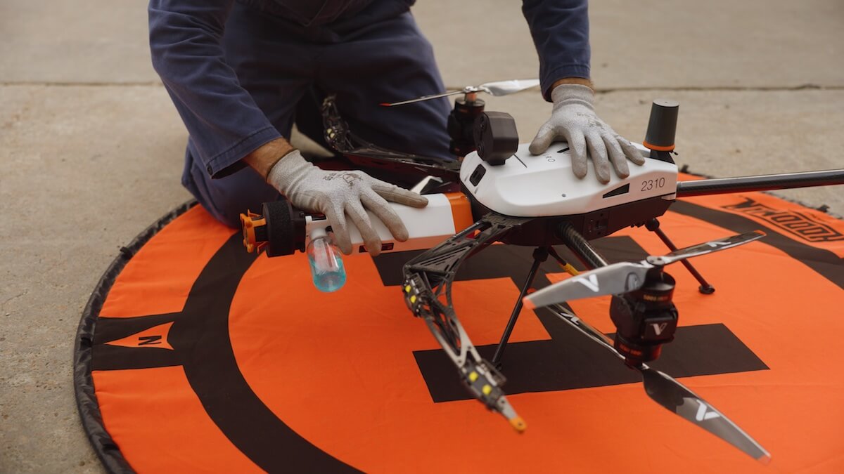
For instance, the Voliro inspection drone includes six swappable payloads for non-destructive testing (NDT), developed in compliance with industry standards. The best enterprise drones also feature open payload platforms to accommodate custom equipment and ensure full integration with drone controls.
Voliro T with payloads
Rugged Design
Because enterprise drones are usually sent on challenging missions — down into the storage tanks, offshore towards wind turbines, or straight into the depth of mining shafts — they require extra durability.
Carbon fiber composites are a frequent material choice for drone frames and structural components due to their exceptional strength-to-weight ratio. Reinforced carbon also has high fatigue resistance, prolonging the assets’ service life.
To remain operational at extreme temperature ranges, drone manufacturers also use temperature-tolerant onboard electronics e.g., Printed Circuit Boards (PCBs) made from Polyimide or FR4-HT, and apply silicone or acrylic conformal coatings to ensure thermal insulation.Similarly, enterprise drones get extra protection against moisture and dust. Look for an IP55 rating if you want the best protection against rain.
For extra reliability on long-range missions, enterprise drones include design-level redundancies such as:
Dual battery systems
Failover flight controllers
Dual communication links
Redundant inertial navigation system (INS) components
Coupled with advanced obstacle sensing and detection capabilities, all of the above mechanisms ensure that the drone can safely return home even in case of a hardware mishap.
Advance Navigation Features
Lastly, enterprise drones give pilots greater control over flight mission planning and execution.
On the hardware side, the best models come with real-time kinematic positioning (RTK) or Post-Processed Kinematics (PSS) onboard units. Both provide GNSS signal correction by correlating satellite data from the base station with the drone’s own Generally, either technology substantially improves data collection accuracy and simplifies geotagging for subsequent modeling.
Here’s how the two compare:
RTK vs PSS in Enterprise Drones
Characteristic
Real-time kinematic positioning (RTK)
Post-Processed Kinematics (PSS)
Data Processing
On live, real-time data
On recorded flight data
Error correction
Corrections applied in real time during the flight
Signal corrections applied after the flight
Setup
Requires setup and calibration of real-time links on a ground station
Requires setup of base stations or access to reference networks
Signal dependency
Requires constant, uninterrupted coms link between the base station and the drone during flight. Susceptible to signal interference.
Continuous communication isn’t required. More dependable in challenging terrains
Accuracy
Sub-centimeter level absolute horizontal accuracy in optimal flight conditions
Similar to RTK, when processed
Additionally, the best enterprise drones employ extra technologies to offer navigation in GPS-denied environments.
For indoor and confined inspection drones, the main method is Simultaneous Localization and Mapping (SLAM) — a technique for real-time map generation on the edge device. A SLAM system uses a combination of LiDAR and visual data from cameras to localize the piloted system in GPS and generate a point cloud of nearby surroundings. With all processing done on device, the drone gains high situational awareness without a GPS signal.
Another approach is sensor fusion. In this case, the onboard unit processes data from the drone’s Inertial Measurement Unit (IMU) to determine its location, orientation, and movement trajectory in a GPS-denied environment. An Al algorithm then guides the drone through the pre-planned flight route or returns it home. Unlike SLAM, sensor data fusion demands less computational resources and is less battery draining.
When it comes to drone autonomy, enterprise drones offer a roster of great capabilities, ranging from automated asset orbiting for industrial photogrammetry to auto terrain follow in land surveying, or AI-powered route and interaction optimization for complex missions. Multi-dimensional obstacle sensing and avoidance is also a given.
Top Enterprise Drone Use Cases
Drones took over operational tasks that previously required lengthy on-foot patrols, a chartered plane, or specialized lifting equipment. In the Oil and Gas sector drones are used to survey kilometers of pipelines for integrity. In the telecom sector — to perform site surveying and network planning and optimize asset maintenance.
Let’s go through a few of the most popular use cases of enterprise drones across various industries.
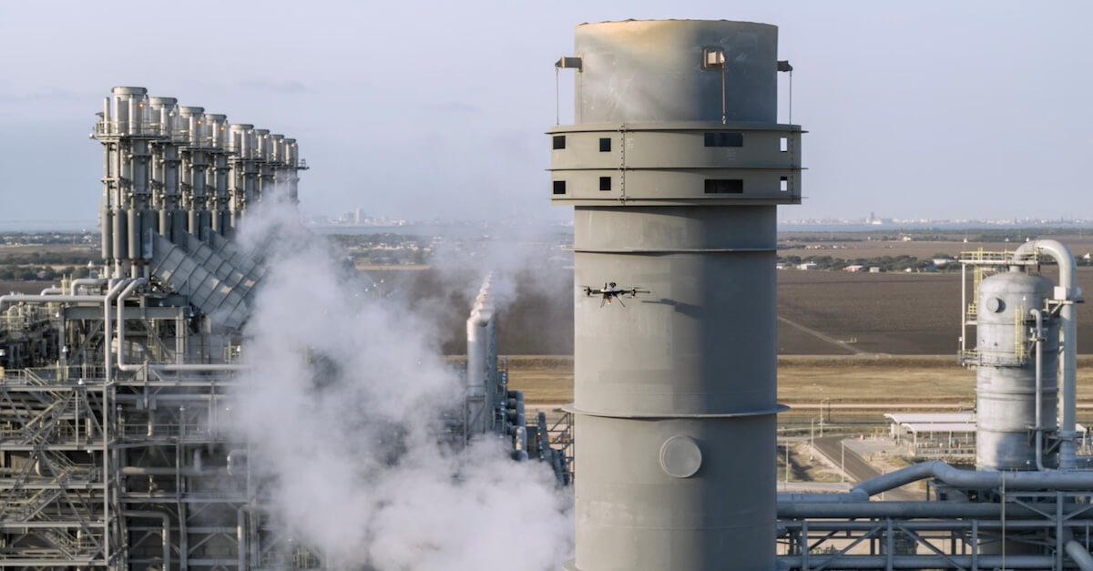
Visual Asset Inspection
Visual inspections help discover surface-level quality issues, textural deformations, signs of damage, or depreciation in industrial assets. Regular inspections are necessary for regulatory compliance in many industries —- from chemicals and construction to power and telecom.
Industrial inspection drones, equipped with robust imaging systems, combining wide angle, telephoto, thermal, and RGB cameras, allow teams to cover larger areas in less time and collect high-fidelity data from every angle. Automatic data collection modes and AI-assisted guidance drive extra operating efficiencies. With Voliro drones, one engineer can inspect 10+ towers for structural integrity.
Specialized software also streamlines industrial photogrammetry. Perform asset scanning faster using pre-made flight templates and automated data capture modes. Then export all geotagged data into your preferred software to maintain an always up-to-date digital inventory of your most critical infrastructure.
Common use cases:
Storage tank inspection
Powerline inspection
Bridge inspections
Pipeline inspections
Shiploader inspections
Non-Destructive Testing
Non-destructive testing (NDT) is the go-to method for performing quality assurance and material examination in the industrial sector. Applicable to alloys, metal, concrete, coatings, castings, forgings, and welds, different NDT techniques help with early damage, corrosion, and sub-surface quality defects in mission-critical assets.
Although many inspectors still rely on conventional hand-held equipment and supporting structures (scaffolding, cherry pickers, lifts), specialized NDT drones are also seeing more action.
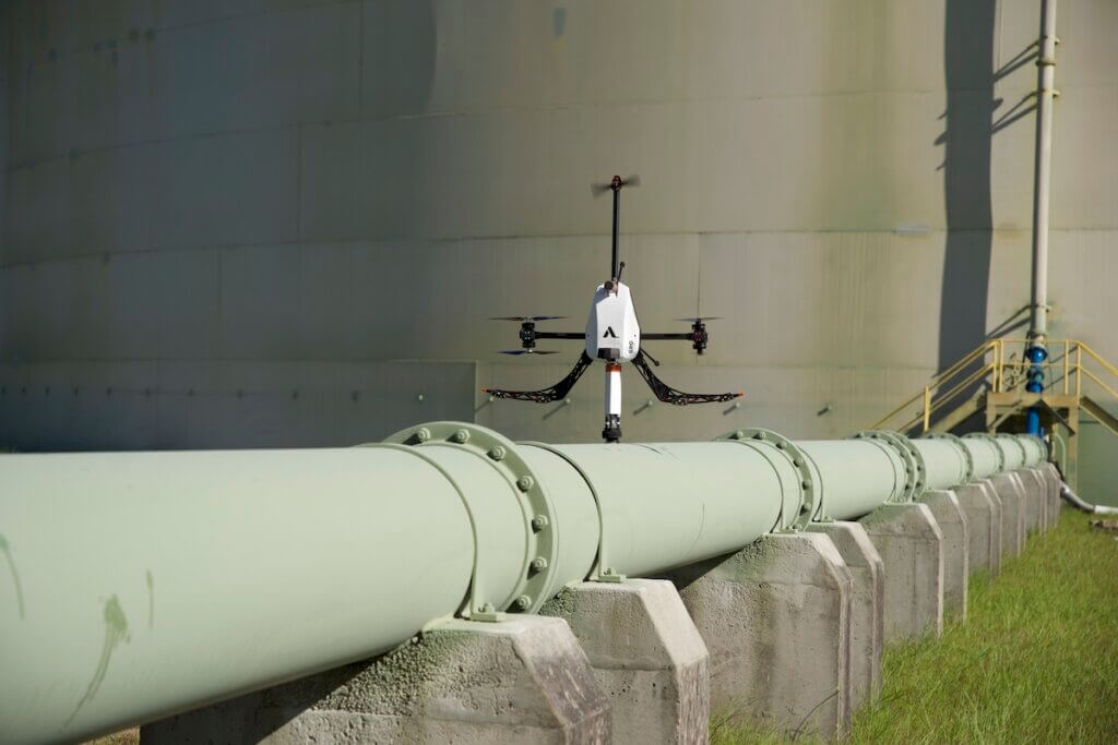
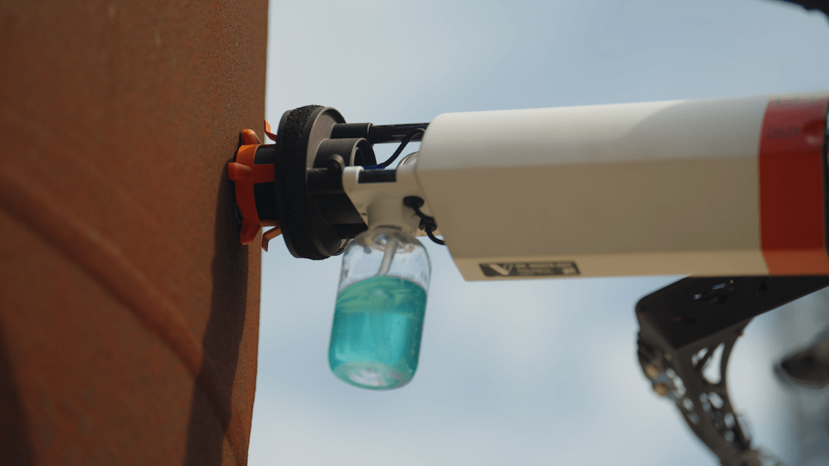
By combining omnidirectional mobility with high stability and precision for payload manipulations, drones provide easy contact with the surface for performing tests. Voliro drones can be equipped with different payloads to perform NDT tests at height from any angle.
Compliant with EN 12668-1 and ISO 16831:2012, our UT probes take wall thickness measurements at a range 4-150 mm. The high-temperature version can be used against surfaces heated to 260 °C / 500 °F like flare stacks and chimneys, eliminating asset downtime. Dry-Film Thickness (DFT) measurement probe provides magnetic induction and eddy current measurement readings with a range of 0 to 1500 um / 700 um. The upcoming Pulsed-Eddy Current (PEC) probe can identify corrosion under insulation on metal structures.
Tiltable rotor design provides six degrees of freedom (6DoF) mobility, enabling inspection of curved and sloped surfaces. Two six-packs of LiDAR distance sensors and vision-based velocity sensors, as well as an RTK unit and AI interaction assistance, reduce the odds of collisions to the bare minimum.
Voliro T drone takes UT measurements on an industrial pipe
Common use cases:
Corrosion detection on elevated assets
Weld inspections for defects
Concrete structure assessments
Wall thickness measurements of pressure vessels
Protective coating inspection
Heat exchanger inspections for fouling
Mapping and Surveying
The best enterprise drones come with survey-grade onboard technologies: downward-facing RGB or multispectral cameras, LIDAR payloads, and laser range finders. Thanks to onboard RTK/PSS, all footage is tagged with accurate geo-coordinates, reducing subsequent modeling complexity.
The main benefits of using drones in surveying and mapping: less field time and more data. Drones can capture thousands of measurements in a single flight, which can be over an hour with surveying VTOLs like WingtraOne or gas-electric quadcopters like Noa Hybrid. Advances in automation also make long-range missions less enduring for pilots. The best drones can automatically follow the terrain i.e., keep the same height above ground in real time without direct adjustments. Or even autonomously execute the flight, based on the input waypoints and coordinates with little manual adjustments from the pilot.
The HD orthomosaics and 3D models generated from drone surveys facilitate accurate distance and surface measurements, volumetric calculations, and terrain analysis. These capabilities are irreplaceable for better cadastral mapping, construction planning, and inventory management in queries, among other use cases.
Common drone use cases:
Agriculture land surveying
Construction site mapping
Stockpile volumetric measurements
Urban development assessments
Road infrastructure planning
Public Safety and Site Security
When disaster strikes, timing is critical. Drones provide frontline workers with a new vantage point in a range of emergencies.
Rescue teams can assess the flooding areas and detect people’s presence with thermal cameras. Police units can assess the accident site before deciding which units and equipment to dispatch. In Denver, US, the police department plans to launch a drone program for investigating certain 911 calls.
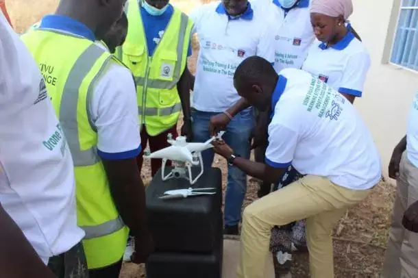
Firefighters can monitor wildfire spreading in real time to alert nearby residents and devise better contingent plans. The Oregon Department of Forestry (ODF) uses drones to detect smaller wildfires and coordinate efforts during bigger incidents without putting personnel in danger. Phoenix Fire Department dispatches drones daily for search and rescue operations on the trails, alerting firefighters about brush fire movements. Gambian authorities, in partnership with Unesco, are implementing an early warning system for floods that relies heavily on drones.
Rescue teams in Gambia learn to use drones. Credit: Unesco
In other words: Drones provide high-fidelity situational awareness, enabling more informed decisions and better resource coordination.
Private businesses are using drones to ensure site security. With advances in computer vision technologies, drones can automatically detect people’s movement, recognize objects (like approaching vehicles), and auto-follow them at a distance to give security forces better situational intelligence.
Common drone use cases:
Search and rescue operations
Traffic accident management
Natural disaster monitoring
Monitoring of perimeter security:
First response planning
Environmental Monitoring
Drones are also taking a central role in environment monitoring and conservation. Aerial data provides more detailed snapshots of natural habitats, including definitive data on vegetation indexes, land erosion rates, and biodiversity. Swiss researchers are developing a drone system for collecting air samples in rainforests and plant swabs in the forest canopy.
Wildlife conservation specialists use drones to study migratory patterns, conduct population surveys, and monitor habitat changes. A team in Central America, for example, is using drones to measure the thermal environment of endangered lizards — a task that previously required tedious lab work. Additionally, drones with thermal imaging capabilities help prevent illegal poaching, providing real-time surveillance to patrolling teams.
Industrial companies are also turning to drones for emission rate monitoring. With on-board chemical and gas sensors, modern drones can detect the presence of hundreds of different substances in the atmosphere, giving owners better insights into their pollution levels. The port of Klaipėda in Lithuania used drones to monitor over 140 ships for exhaust gas quality over the span of three months to document instances of water pollution and measure the sulfur content in ship exhaust emissions.
French energy company TotalEnergies went a notch further and developed a drone-mounted ultralight CO2 and CH4 sensor for collecting high-precision readings in real time. Based on a diode laser spectrometer, the sensor can detect methane emissions with a > 1 kg/h level of accuracy.
Common drone use cases:
Air quality monitoring
Forestry management
Wildlife monitoring
Land degradation detection
Water quality assessments
Best Enterprise Drones on the Market
The global enterprise drone market is already worth almost $20 billion, and growing at an annual CAGR of 13.9%. By the roughest estimate, there are over 40 drone manufacturers, offering a range of models — and new releases hit the shelves every half a year. So the sheer choice of commercial drones for sale is overwhelming.
The “best” choice for your business will depend on your use case(s). Drone models stand out for different capabilities — photogrammetry, contact-based work, object detection, and indoor navigation.
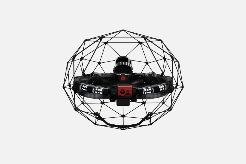
For indoor and confined spaces inspection — Elios 3
Voliro T
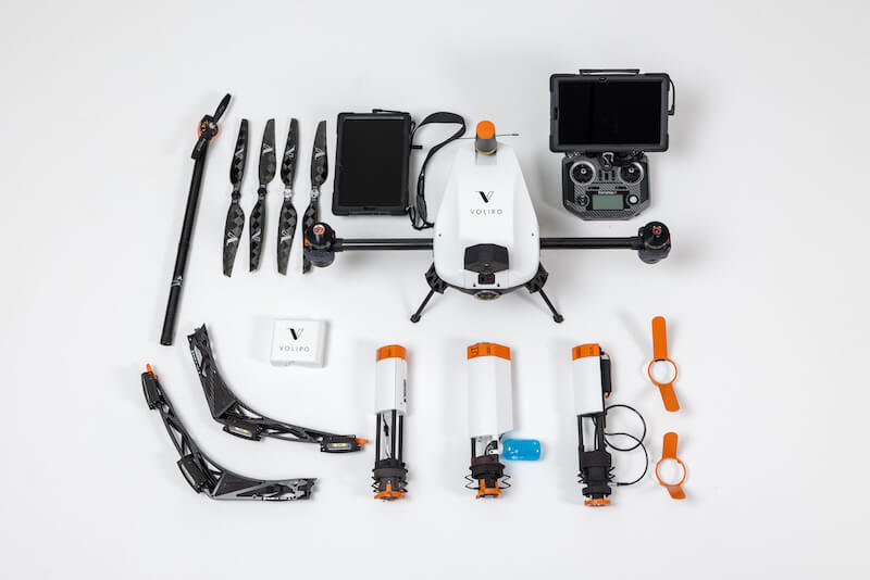
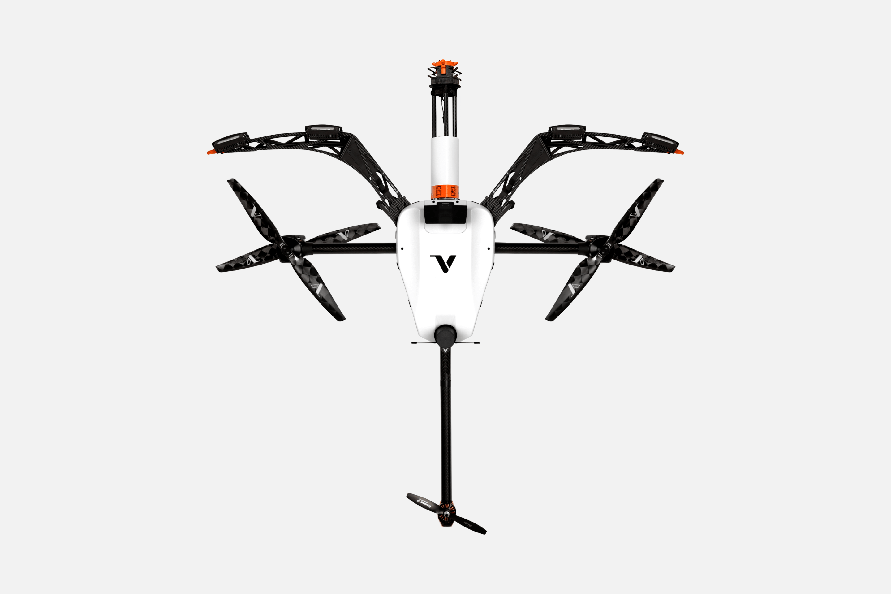
Voliro
With advanced features like thrust vectoring, 6 degrees of freedom (6DoF) control, and precise onboard navigation sensors, Voliro inspection drone excels in close-to-surface work. It can apply 30 N of stable force and several Nm of torque to structures, enabling precise manipulation with the mounted payloads. These include two ultrasonic transducer versions for wall thickness measurements, an EMAT for contactless surface testing, a DFT gauge for protective coating inspections, and a specialized needle probe for lightning protection systems. PEC payload for aluminum and low-carbon steel thickness measurements is coming in Q4 2024 and we can accommodate custom integrations.
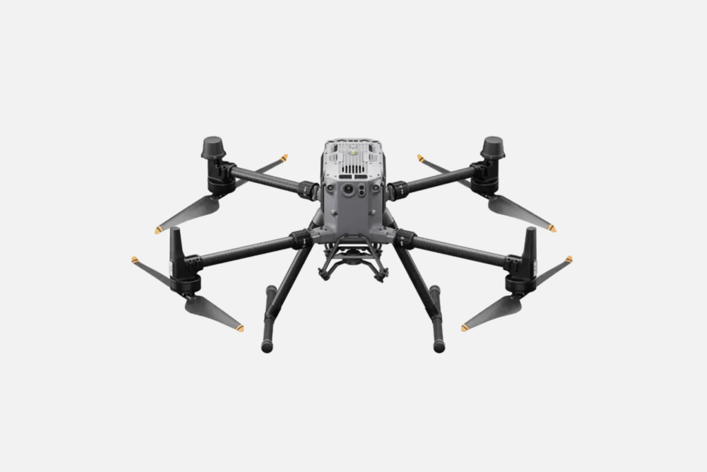
Heavy rain or winds up to 12 m/s, DJI Matrice 350 RTK remains steady in the air. Its advanced O3 Enterprise Transmission system provides HD live feed up to 20 km in the US (8 km in the EU), while a sophisticated four-antenna system enhances signal quality and anti-interference capabilities. With a total payload capacity of 2.7 kg, DJI Matrice 350 RTK can be furnished with a Zenmuse H20 gimbal camera system (available with and without a radiometric thermal camera), plus carry two other payloads, including custom ones compatible with DJI SDK. Matrice 350 RTK also boasts an optimized battery system, extensive obstacle-sensing range, and a night-vision first-person view camera, making it a versatile tool for various commercial applications.
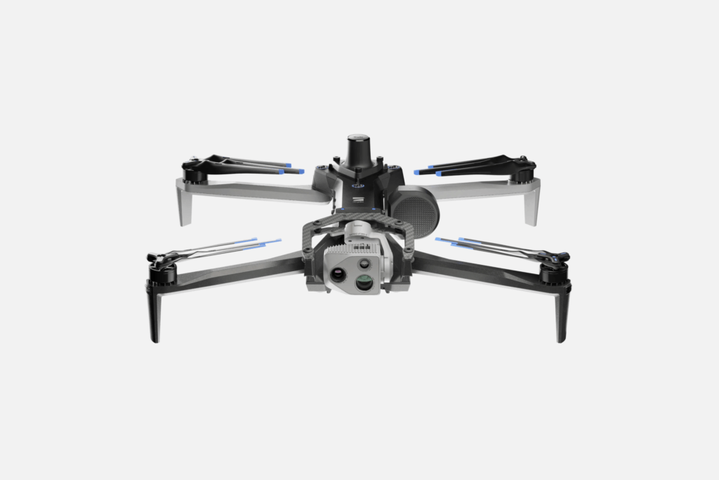
What makes Skydio X10 a standout model is stellar footage quality, courtesy of a three-sensor camera system. It combines a 64 MP narrow and 48MP telephone camera with a Teledyne Flir Boson-based thermal camera. A wide field of view and robust zoom lets you capture the smallest surface details and thermal readings have a sensitivity down to 30 mK. Proprietary flight planning supports autonomous data capture modes for industrial photogrammetry and subsequent point cloud data processing for 2D/3D asset modeling. Thanks to Onboard Modeling you can review scanned scenes from the flight controller app and use contour-hugging motion planning to survey the scene from every direction.
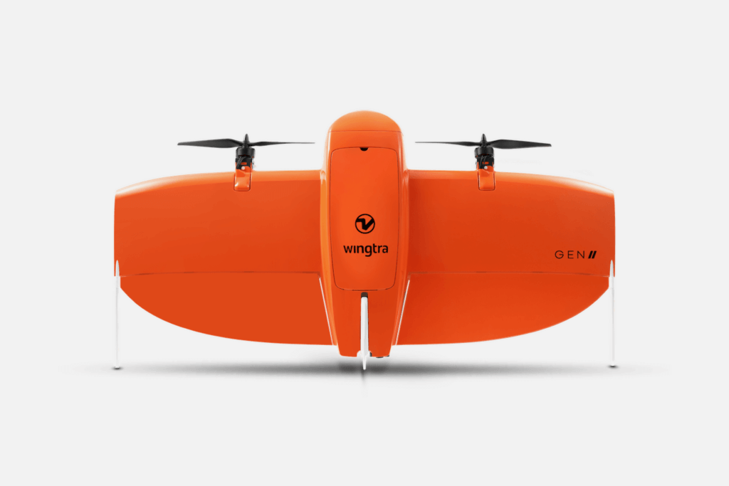
WingtraOne is one of the best VTOL drones on the market for survey and mapping missions. Reinforced high-altitude propellers enable data collection at up to 5000 m and a pair of 99Wh batteries keep the drone up for up to an hour. The combination of built-in PPK GNSS antenna and 61 MP cameras, allows absolute horizontal accuracy down to 1 cm, and Ground Sample Distance (GSD) down to 0.8 cm/px, both validated during field tests. WingtraOne’s advanced mission planning features, such as autonomous launch and landing, corridor mapping, and geofencing, significantly enhance workflow efficiency for large-distance missions. BVLOS approved, WingtraOne data transmission ranges go up to 10 km, making it a powerful tool for professional surveying.
Encased in a protective cage and equipped and powered by a SLAM engine, Elios 3 confidently navigates confined spaces and curving tunnels. A combo of computer vision, LiDAR, and onboard data processing gives Elios 3-centimeter-level indoor positioning accuracy in GPS-denied environments. The drone features a 4K camera and thermal imaging capabilities for detailed visual inspections, detecting issues like cracks and corrosion. Elios 3’s versatility is further extended through add-on payloads, including the LIDAR Surveyor for high-precision 3D mapping, new ultrasonic thickness measurement (UTM) payload for remote steel thickness inspections, and RAD Payload for radiation measurements. Two payloads can be used at the same time to save the hassle of doing repeat flights.
Best for: Indoor Inspections
Discover More Enterprise Drones
Want to learn more about the models’ tech specs and core features? Check full reviews in our previous posts:
Our reviews are based on a combination of market research we do as part of our product development, feedback from our clients, who often have several different drone models in their fleet, and hands-on testing whenever we get a chance.
Our review philosophy is simple: We give credit when credit is due — and call out the potential shortcomings for specific use cases.